
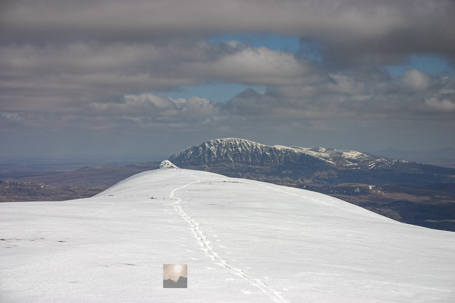
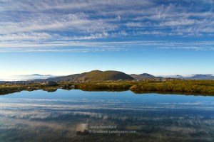
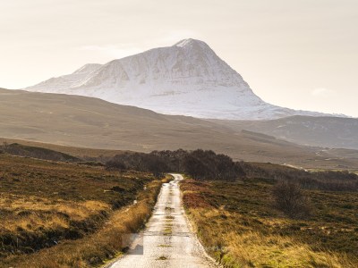
Foinaven and its neighbour Arkle are amongst Scotland’s finest and most starkly beautiful mountains. Foinaven is one of the highest Corbetts – it has several tops but its highest, Ganu Mor, is just short of Munro status at 911 metres or 2989 feet, the mountain’s complex north eastern crags and corries have many rock and ice climbs. Arkle, also a Corbett, is lower at 787 metres and is joined to its larger neighbour by a dipping and sweeping swath of quartzite across Bealach Horn (513m) and Bealach an Easaine Uaine (395m), and is a great hill in its own right.
The mountains lie to the east of the A838 road that connects the villages of Rhiconich and Durness, either of which would be ideal bases for exploring the area. You can search for accommodation here.
Foinaven and Arkle lie at the north end of the Reay Forest range of hills between the River Laxford to the south and Strath Dionard to the north. The peaks are formed from shattered Cambrian quartzite; some of which is Pipe Rock containing the fossilised burrows of worm like creatures, lying on top of the surrounding ancient Lewisian gneiss basement rocks – the British Isles oldest.

| Search for accommodation using Booking.com |
| Buy maps from the Ordnance Survey |
| Buy guide books and maps from Amazon |
Foinaven and Arkle

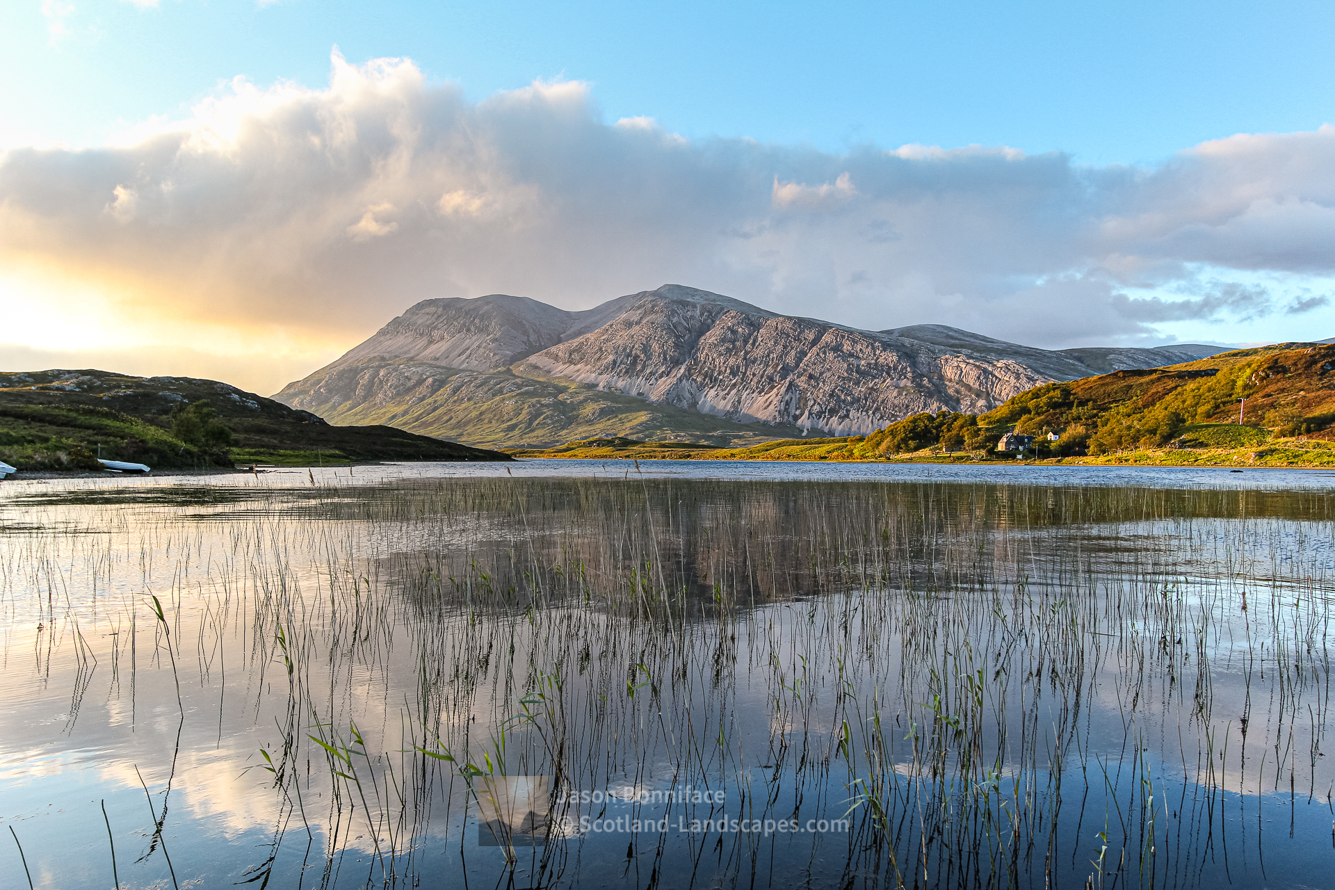


Table of Foinaven and Arkle summit details
| DoBIHID | Mountain | Height | Classification | Image 1 | Image 2 | Image 3 |
|---|---|---|---|---|---|---|
| 1124 | Foinaven | 911m/2989ft | Corbett | Context Image | Detail Image | Summit Image |
| 1129 | Arkle | 787m/2582ft | Corbett | Context Image | Detail Image | Summit Image |
Explore Foinaven and Arkle with the interactive map of the mountains, photos and indicative routes below. Click on a feature to see photos and more information; see a legend by toggling the side panel and switch layers on and off. View a larger map here. Please let me know what you think!
Interactive map of Foinaven and Arkle including the Corbett summit and photos
Important note: Routes on this map are provided as an indication only in good faith. They are approximate and indicative and should not be relied on for navigation or as a guarantee that any specific person will be capable of completing them. Read more
Climbing Foinaven from A’ Ghualainn to the north (near Gualin House)
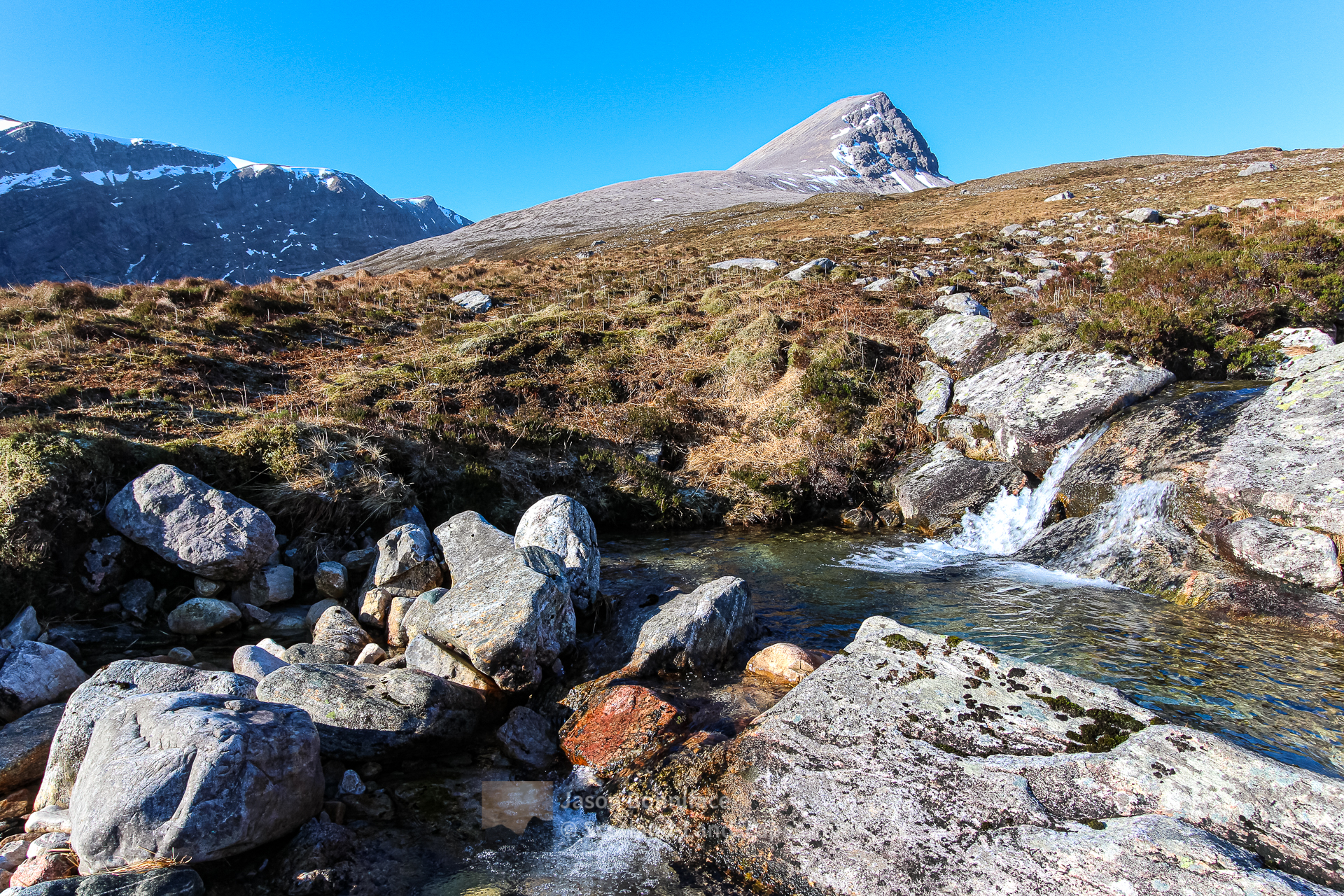
Gualin House lies in trees at the high point, A’ Ghualainn, of the A838 (NC500) road between Rhiconich and Durness. There is a small parking area a little north and downhill from the house, or several possible small pull offs to the south west in the Rhiconich direction. Starting from this area there are two main options for approaching Foinaven: either a slog over several kilometres of boggy, pathless ground to reach the base of the north west ridge of Ceann Garbh; or a longer approach via the track down into and along Strath Dionard. I’d recommend the Strath Dionard approach as you get to see the fine north eastern crags and corries of the mountain as well as the strath itself. An approach by bike along the track is a good option – though the final steep cycle back up the hill to the road is a challenge! From Strath Dionard there are many possible routes on to the peaks of Foinaven with a range of technical difficulties.


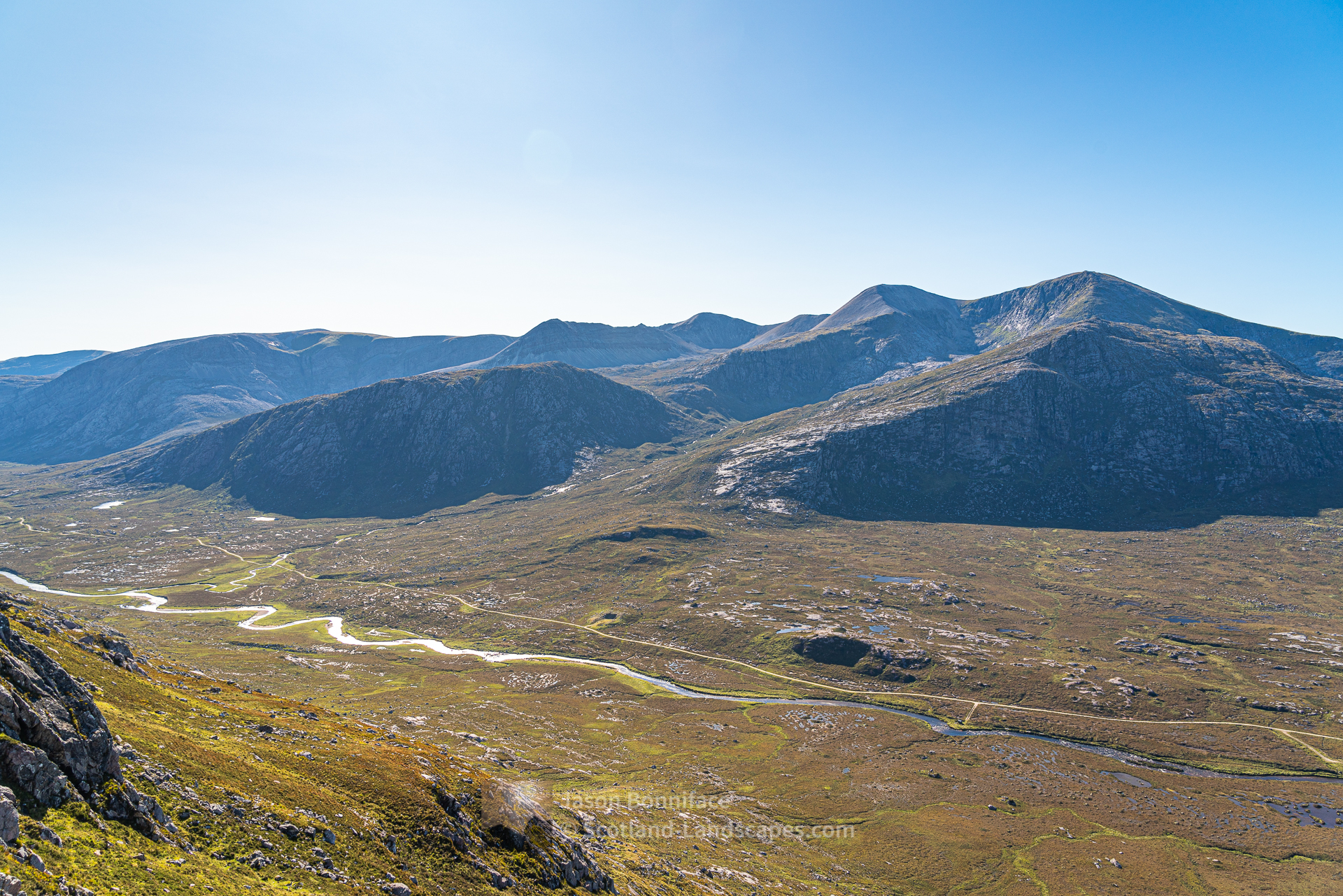


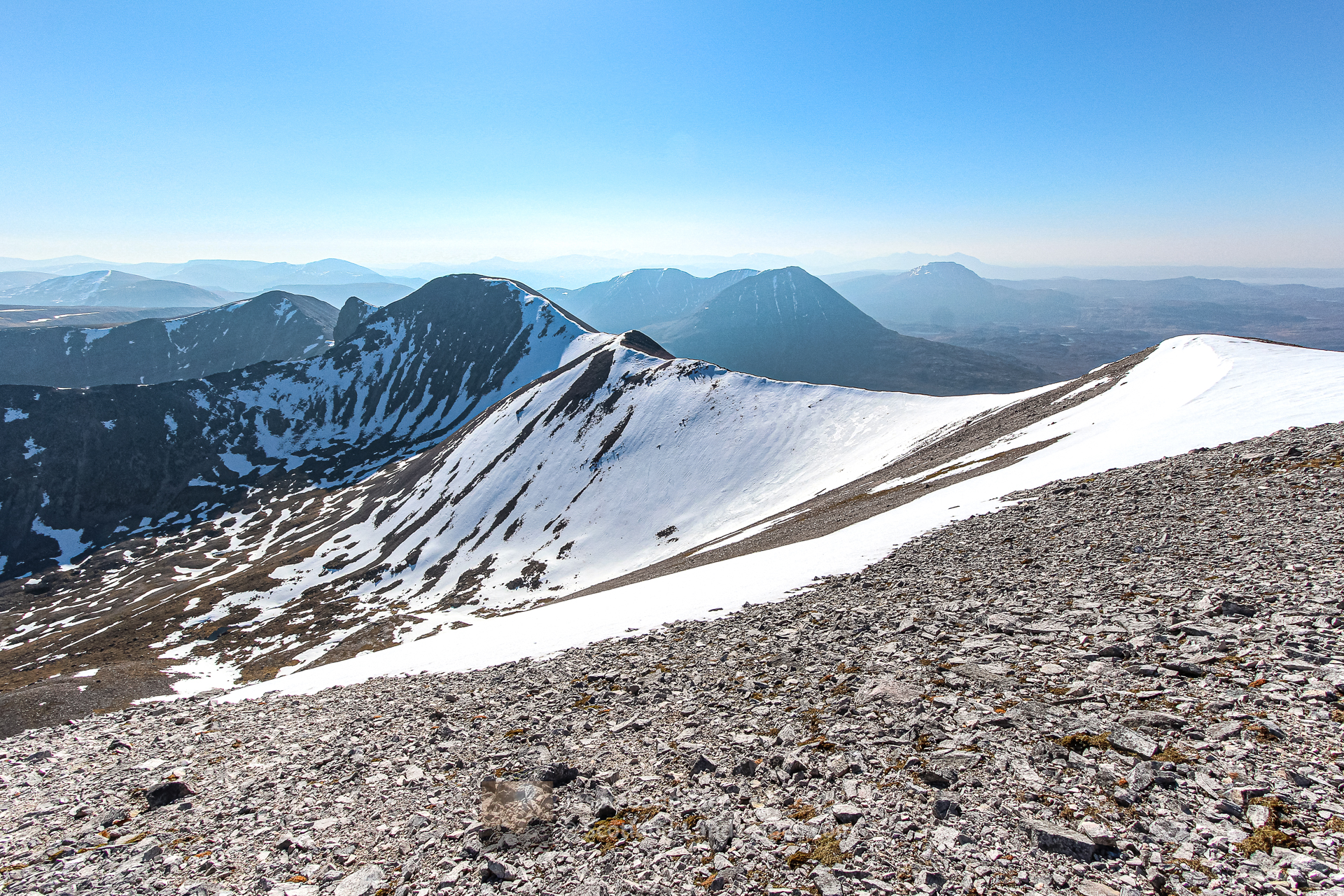
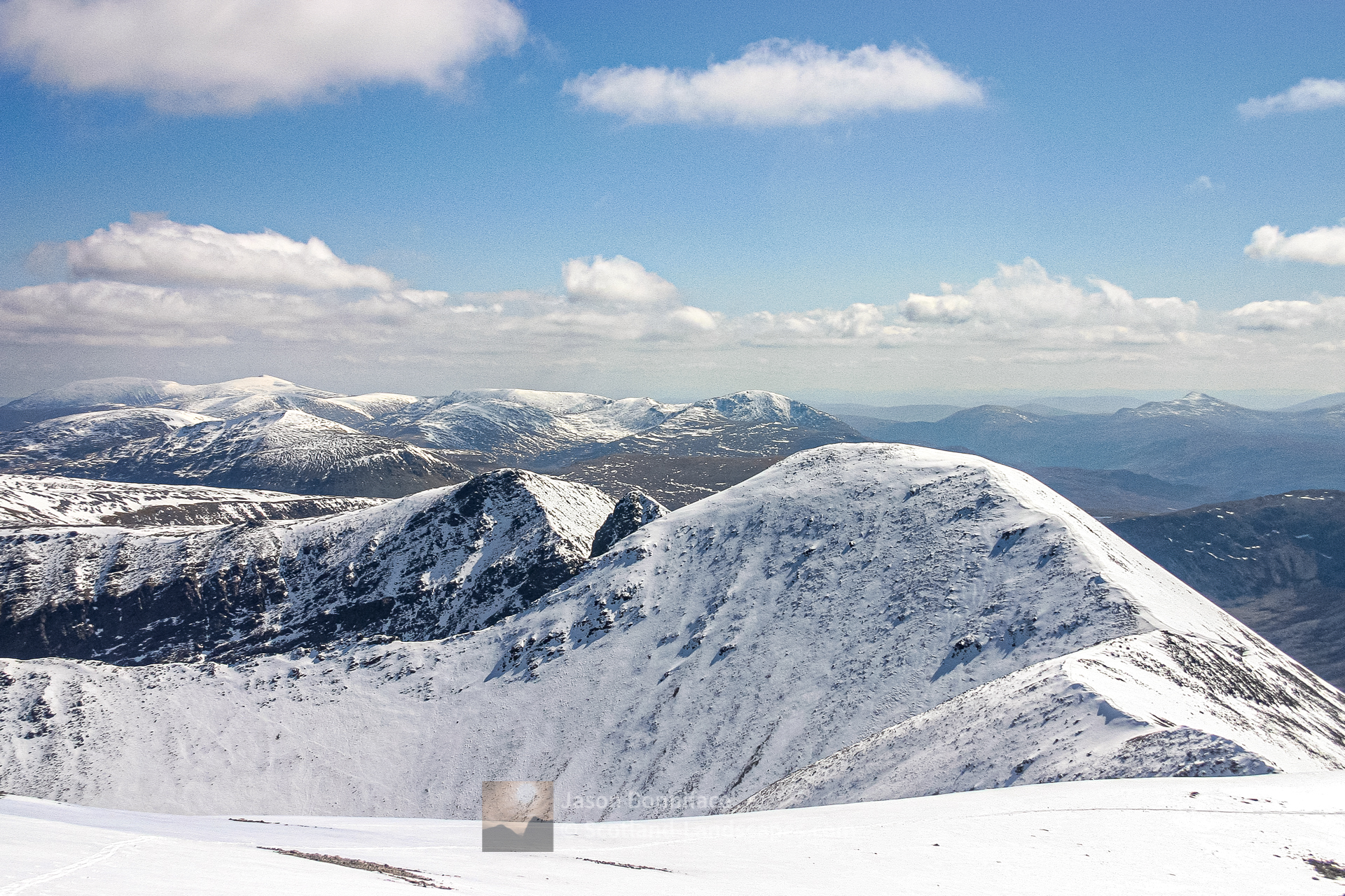
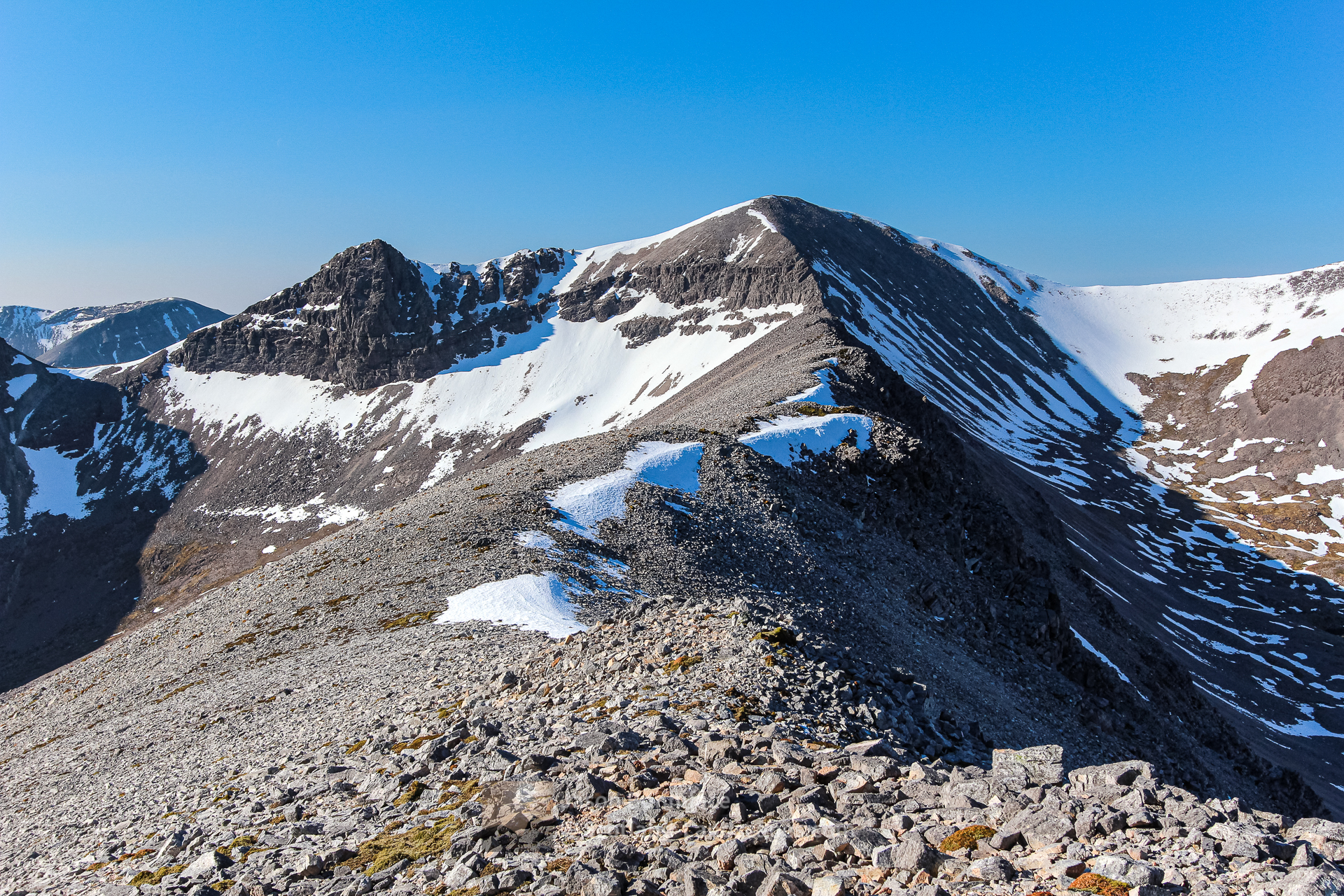
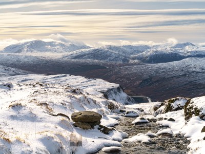
The most common route on to the hill from Strath Dionard may be to head into Coire Duail and then up hill to the north west to the foot of Ceann Garbh’s north east ridge – alternatively take to the eastern flank of Cnoc a’ Mhadaidh to get on to higher ground earlier to approach the ridge. Ceann Garbh’s north east ridge leads steeply to Foinaven’s most northerly top. From Ceann Garbh it is an easy kilometre walk round the rim of Glas-Choire Granda to the summit of Foinaven’s highest peak, Ganu Mor.


To return to the road from Ganu Mor all options involve steep pathless ground. You might want to return to Ceann Garbh and descend its north west ridge to the bog below; or descend to Strath Dionard, perhaps by Ganu Mor’s north east and then lower easterly ridge and pass over or south of Cnoc Duail (it is also possible to drop back in to Glas-Choire Granda or Coire Duail with care at certain locations). Alternatively a descent of the south face of Ganu Mor can be made direct in to Braigh a’ Choire Leacaich for a 3.5 kilometres walk out to the Strath Dionard track.
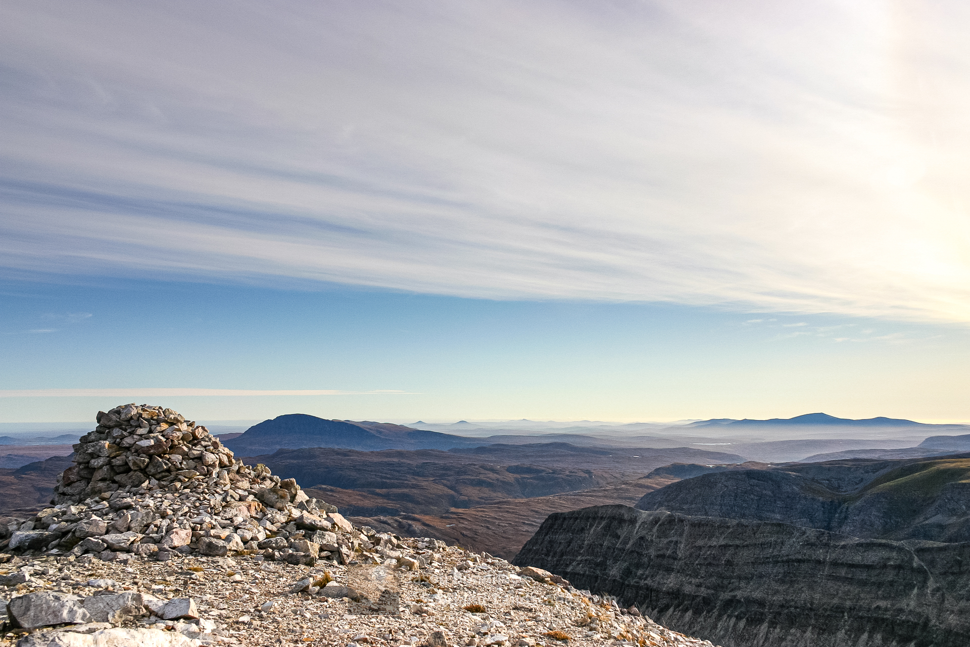
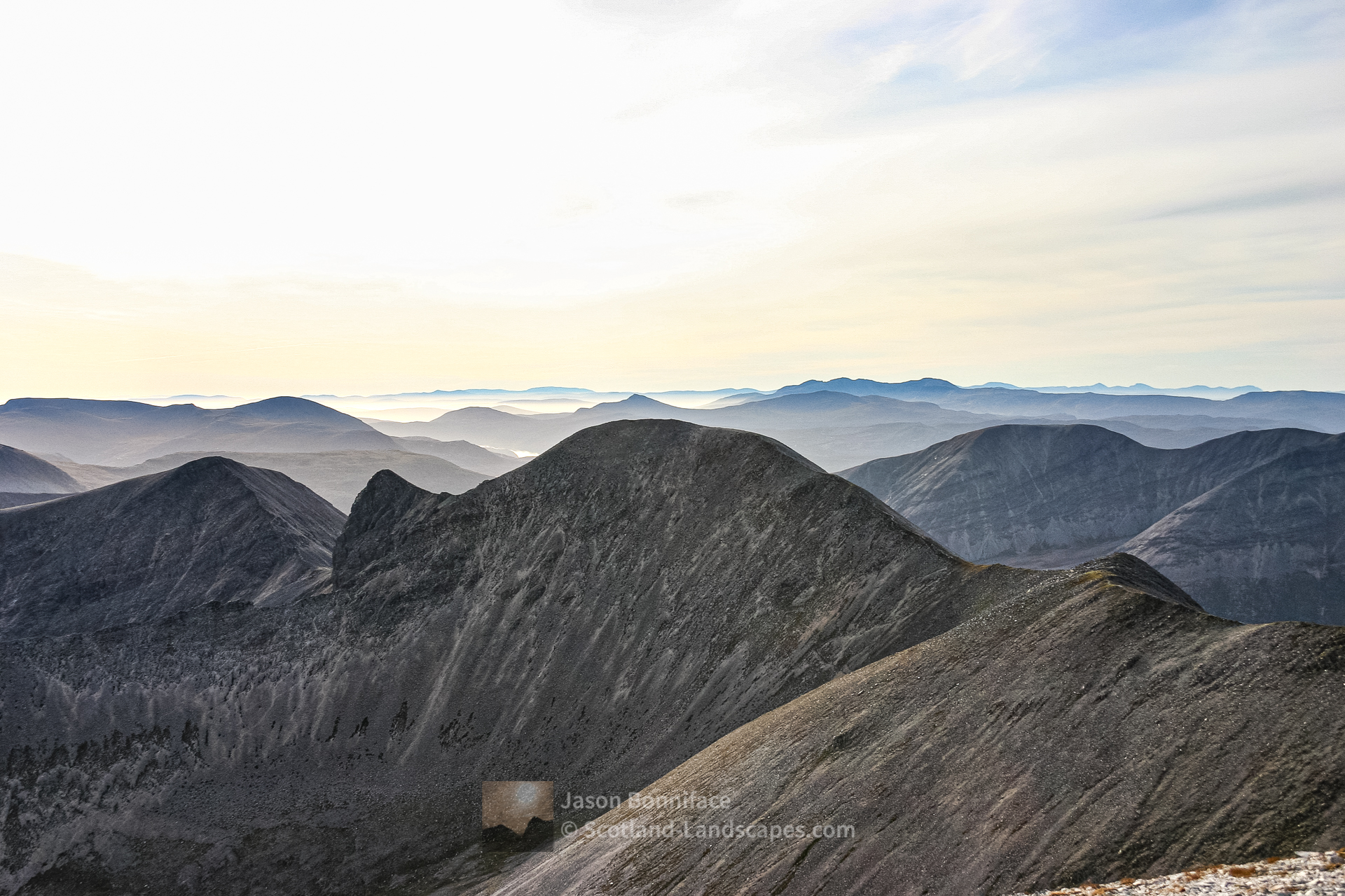
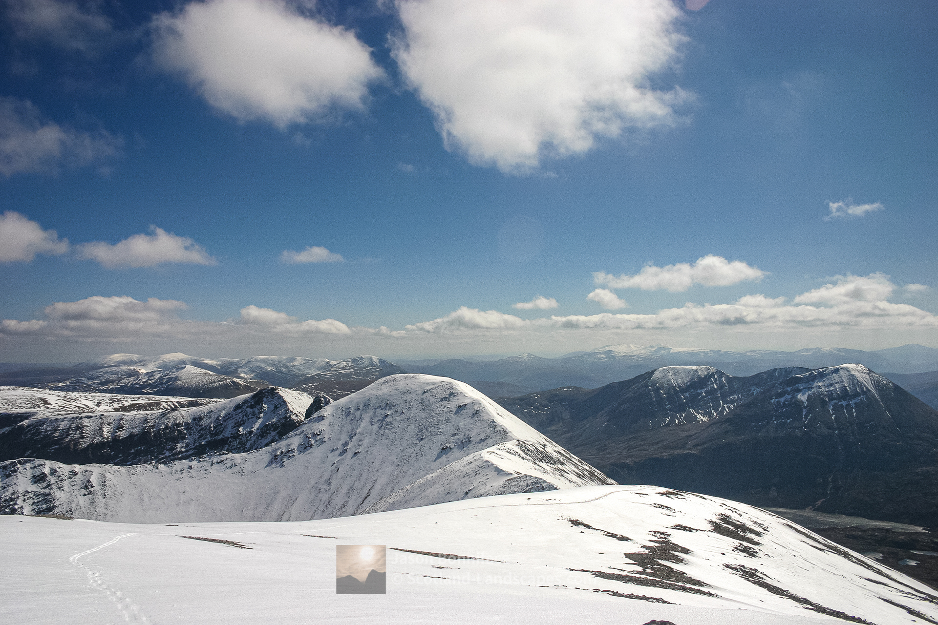
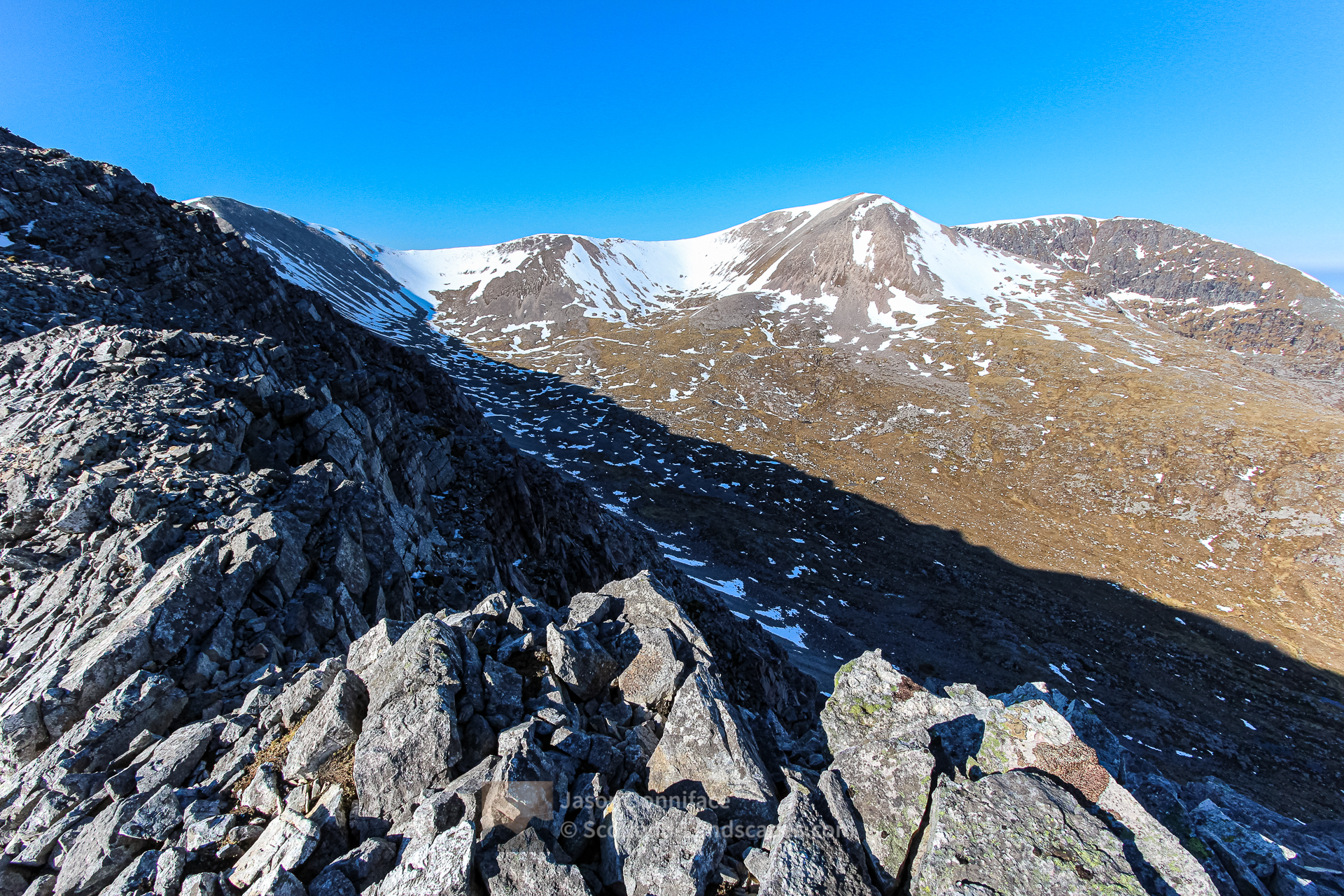
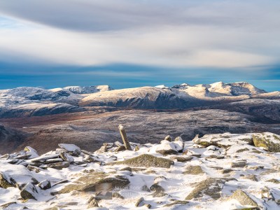
However, from Ganu Mor it would be a shame not to continue along the lovely atmospheric winding ridge to the south to the nameless top at 869m if time and energy allow. The ridge is quite narrow but not difficult. Point 869m is a wonderful viewpoint giving a lovely perspective along the sharp length of A’ Cheir Ghorm and over the moors to Ben Hope and the Flow Country to the east; and to the south along the Foinaven ridge over the sharp Sgurr Cadha na Beucaich (as named in the DoBIH, aka Lord Reay’s Seat) and Stob Cadha na Beucaich to the Reay Forest hills beyond; and to Arkle.


The southern Foinaven ridge – point 869m to An t-Sail Mhor and Bealach Horn
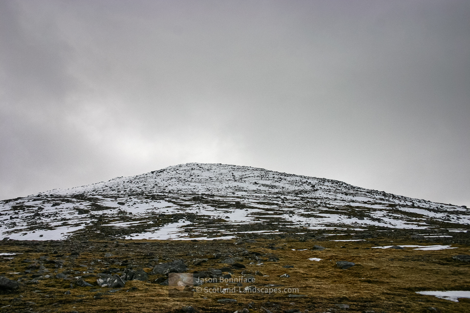
From point 869m the main ridge descends south east to a flattening before rising again a few metres to the promontory of Sgurr Cadha na Beucaich (Lord Reay’s Seat). It makes a fine viewpoint and the crags on the east side drop away very steeply indeed into Coire na Lurgainn – these hold some very difficult winter climbs in particular. The main ridge drops away more steeply after and the terrain is rough to the bealach of Cadha na Beucaich and on up to Stob Cadha na Beucaich (808m) – which is a steep pull.
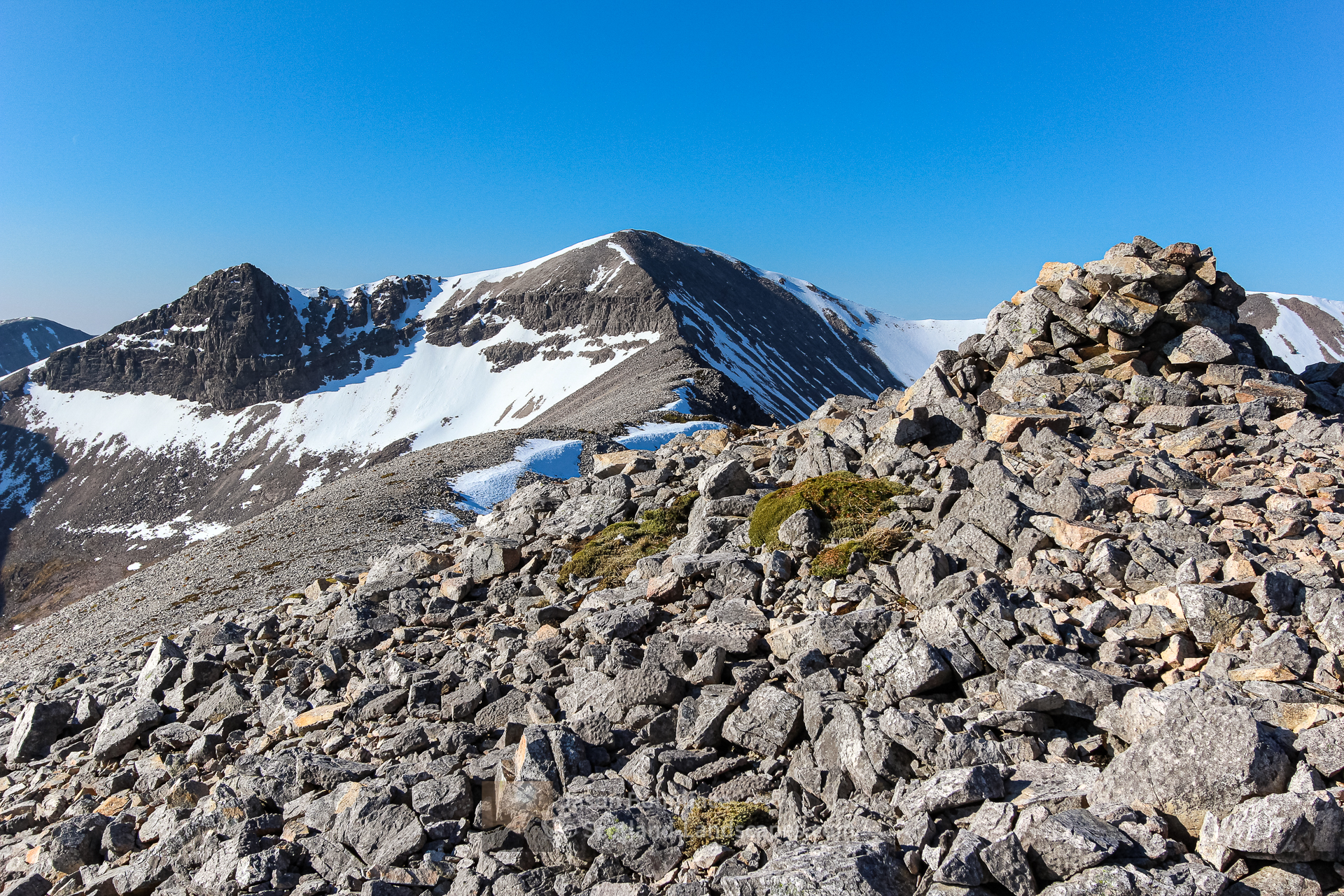
After the summit cairn of Stob Cadha na Beucaich the terrain changes rapidly, the narrow rocky ridge gives way to an expansive high level grassy and stony plateau and gently sloping bowl. The going to An t-Sail Mhor is relatively easy and although not the most spectacular of Foinaven’s tops it is a very fine viewpoint.


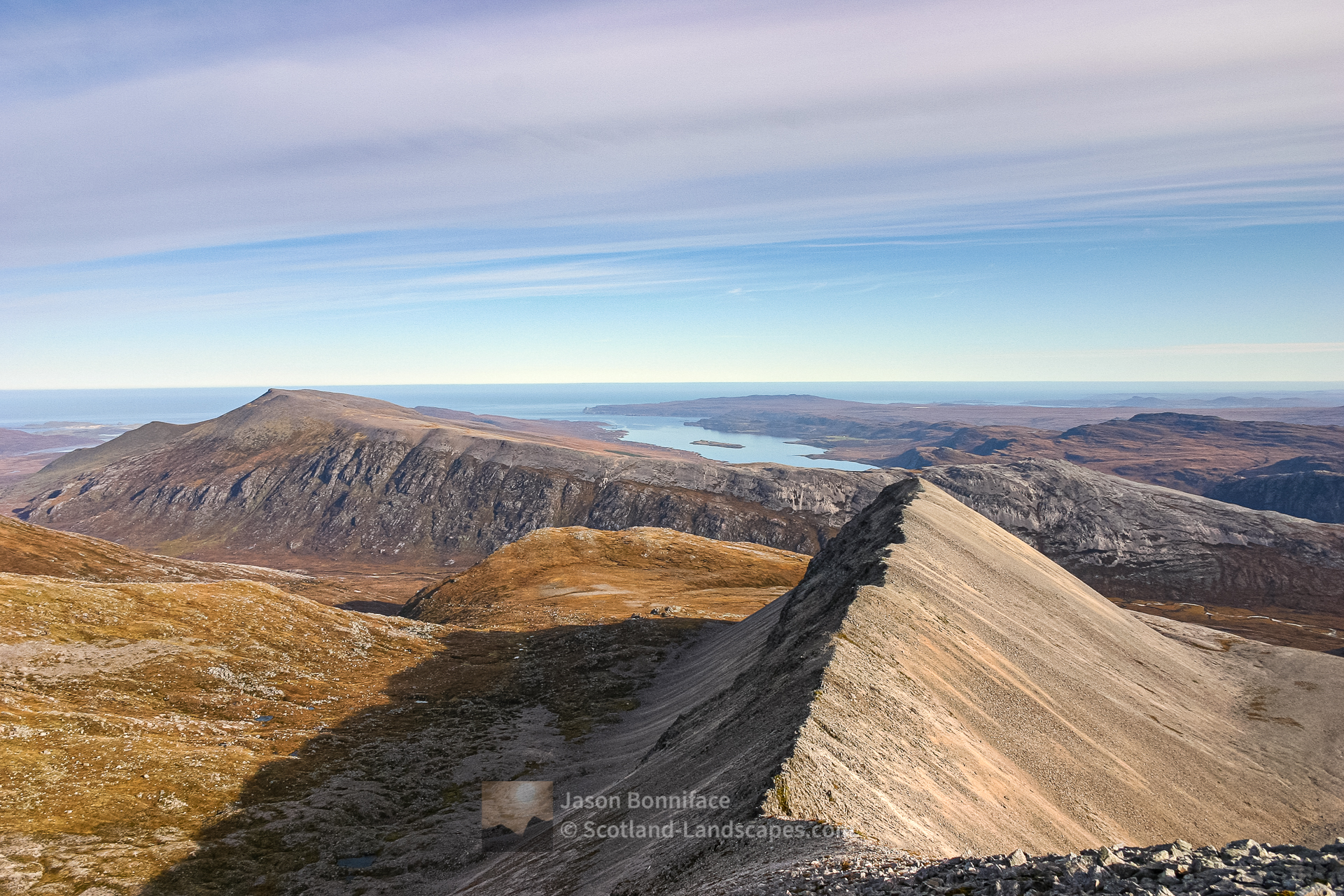
From An t-Sail Mhor the descent to Bealach Horn is gentle and becomes more grassy and boggy as height is lost. The path from Lone on Loch Stack to the south west is joined at Bealach Horn. To the east this descends into the head of Strath Dionard and appears to peter out; or a branch can be followed further east to Glen Golly and Gobernuisgach Lodge in Strath More. A big circular walk or cycle can be made over rough terrain using this path and a more southerly return over the Bealach na Feithe from Gobernuisgach back to Lone.


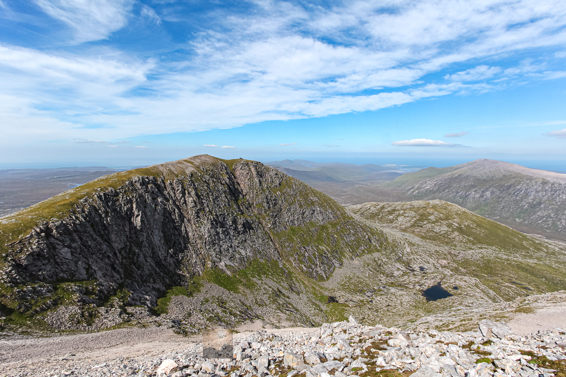
The A’ Cheir Ghorm outlying ridge
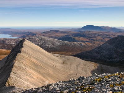
For me, A’ Cheir Ghorm is a sublime place – despite (or perhaps partly because) of it being “just” an outlying ridge of modest height. Something about its shape, form and remoteness capture my imagination. It’s not a main summit, not a Munro or Corbett tick (of which I’m as guilty of pursuing as any), there’s no reason to go there except to explore and experience and you have to go out of your way to do so – and if you do hopefully it will be wonderful.
A’ Cheir Ghorm is most easily reached from either the main Foinaven ridge via a rough descent of the north east ridge of point 869m or via its also rough east flank from Strath Dionard which is likely also the best descent route. The route is largely pathless, rough and remote with steep scree and boulder fields.


See a single gallery of all my best Foinaven and Arkle images
Discover and explore more through the links and articles below.
| Search for accommodation using Booking.com |
| Buy maps from the Ordnance Survey |
| Buy guide books and maps from Amazon |

Beinn Eighe – Ruadh-stac Mor and Spidean Coire nan Clach

Liathach – Spidean a’ Choire Leith and Mullach an Rathain

An Teallach

Ben Hope – the most northerly Munro
Foinaven and Arkle
Sgurr na Ciche, Garbh Chioch Mhor and Sgurr nan Coireachan
Northern Sutherland select photo gallery
Ben Hope – the most northerly Munro
The Foinaven and Reay Forest mountains
Distinct mountains of the Far North

Northern Sutherland
Foinaven and Arkle

Northern Sutherland interactive map

Beinn Leoid and Meallan a’ Chuail


Dun Dornaigil Broch and Strath More
Ard Neackie & Loch Eriboll
Loch Hope and the Hope to Altnaharra Road

Leave a Reply