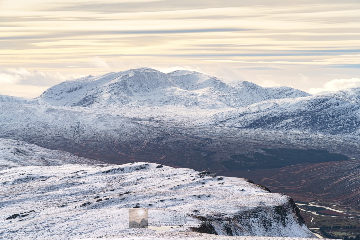
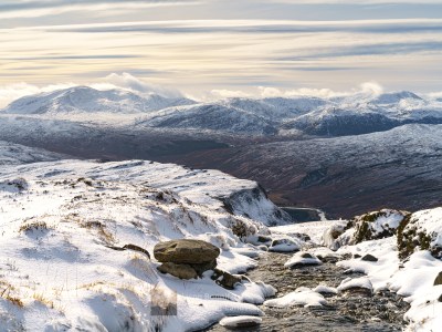
Ben Hee is a big mass of a Corbett with several ridges and corries radiating from its central 873 metre highest peak. It lies at the southern end of the Reay Forest group of hills in Northern Sutherland. It is most easily accessed from West Merkland, on the A838 road north of Lairg and Loch Shin where a track heads north east from the road up to the Bealach nam Meirleach and on over to Gobernuisgach Lodge in Strath More and the Hope to Altnaharra road at Allnabad. The mountain can therefore also be readily approached via this track from the east – made much easier by bike. The mountain occupies a grand position at the south end of Strath More when viewed from Ben Hope to the north.
Accommodation can be booked in the Durness, Tongue or Lairg areas, any of which are ideal locations for exploring the area.
Read on to see and find out more about this fine hill or jump straight to one of the options below:

| Search for accommodation using Booking.com |
| Buy maps from the Ordnance Survey |
| Buy guide books and maps from Amazon |
Ben Hee


Table of Ben Hee summit details
| DoBIHID | Mountain | Height | Classification | Image 1 | Image 2 | Image 3 |
|---|---|---|---|---|---|---|
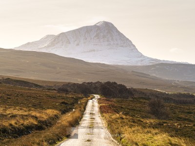
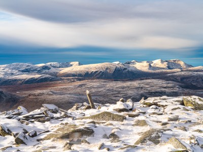
| 1126 | Ben Hee | 873m/2864ft | Corbett | Context Image | Detail Image | Summit Image |
| 3283 | Ben Hee North Top | 851m/2792ft | Simm | Context Image | Detail Image | Summit Image |
Adapted from The Database of British and Irish Hills (DoBIH) under CC BY 4.0
Explore Ben Hee with the interactive map of the mountain, photos and indicative routes below. Click on a feature to see photos and more information; see a legend by toggling the side panel and switch layers on and off. View a larger map here. Please let me know what you think!
Interactive map of Ben Hee including the Corbett summit and photos
Important note: Routes on this map are provided as an indication only in good faith. They are approximate and indicative and should not be relied on for navigation or as a guarantee that any specific person will be capable of completing them. Read more
Climbing Ben Hee from West Merkland
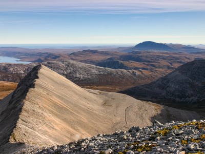
Start up the track on the east side of the Allt nan Albannach river from West Merkland. After about 1.5 kilometres a path branches off east into Ben Hee’s Coir’ a’ Chruiteir. The path climbs quite far into the corrie before petering out in its upper reaches. Here the ground is not too steep and the broad rounded ridge south of Ben Hee’s summit can easily be gained. Rocky ground leads to the summit, named as Sithean Liath nam Peithirean on the OS 1:25k map – which has grand views all round.
The same route makes the quickest and most straight forward descent, alternatively, stay high for longer and follow the south west ridge to Meallan Liath Mor before descending in a north westerly direction towards the access track over some steeper, rough, pathless ground. The west ridge to Sail Gharbh can also be followed, again to a steep, rough, pathless descent off the hill.


Ascent from the Bealach nam Meirleach
An alternative ascent or descent line that might be preferable from the north eastern Strath More/Gobernuisgach approach takes a moorland path along the thin strip of ground between Loch an t-Seilg and Loch an Aslaird midway along the wide Bealach nam Meirleach. The path doesn’t go far up the northern slopes of the mountain but the ground isn’t too bad, the Allt Gharbh-choire Bhig waterfalls scenic, and the Garbh-choire Beag (small rough corrie) can be quite quickly gained. From here the north ridge of Ben Hee leads easily but roughly to the summit.


Ben Hee’s north east top (point 851m)
Ben Hee’s north east top is about 1.5 kilometres from the main summit and can be reached by following the ridge in a northerly and then north easterly direction from the summit around the rim of the easterly An Gorm-choire. It can also be ascended or descended via its north north east ridge. This can be accessed by a long, boggy moorland path from the brilliantly named Chicken Dhu Plantation, on the Hope to Altnaharra road, a couple of kilometres north west of Mudale. One very damp day I had a masochistic walk this way ascending Ben Hee via An Gorm-choire, traversing the north east top, descending north then east to re-join the path out. Unfortunately damp got inside my camera lens and the photos were unusable.


View a single gallery of all Ben Hee images
Discover and explore more through the articles and links below.
| Search for accommodation using Booking.com |
| Buy maps from the Ordnance Survey |
| Buy guide books and maps from Amazon |
Northern Sutherland select photo gallery

Ben Hope – the most northerly Munro
The Foinaven and Reay Forest mountains
Distinct mountains of the Far North

Northern Sutherland
Foinaven and Arkle

Northern Sutherland interactive map

Beinn Leoid and Meallan a’ Chuail


Dun Dornaigil Broch and Strath More
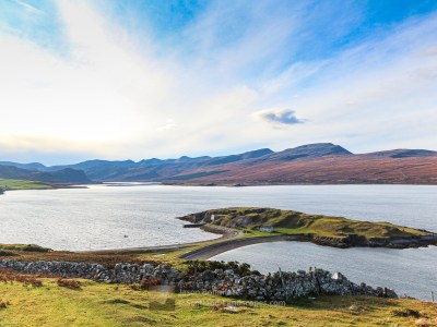
Ard Neackie & Loch Eriboll
Loch Hope and the Hope to Altnaharra Road

Farr Bay, Bettyhill

Ceannabeinne Durness – Grey November Day but Still Beautiful

Ben Hope Summit Camp

Leave a Reply