
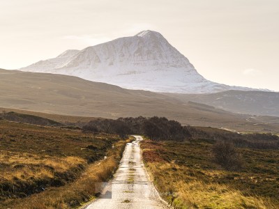
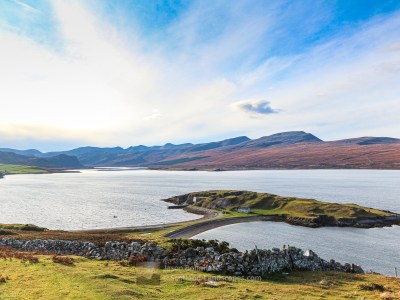
Beinn Leoid and Meallan a’ Chuail are remote charismatic peaks in the area between Loch Merkland and Glen Coul north west of Loch Shin. They are most easily approached by a stalkers path that leaves the A838 road west of the head of the pass between Loch More and Loch Merkland. Beinn Leoid (792m) is a Corbett and the further of the two from the road. Meallan a’ Chuail is a pleasant and quite shapely 750m summit just short of Corbett status and is well worth combining with an ascent of Beinn Leoid.
Accommodation can be booked in the Durness, Scourie or Lairg areas, any of which are ideal locations for exploring the area.
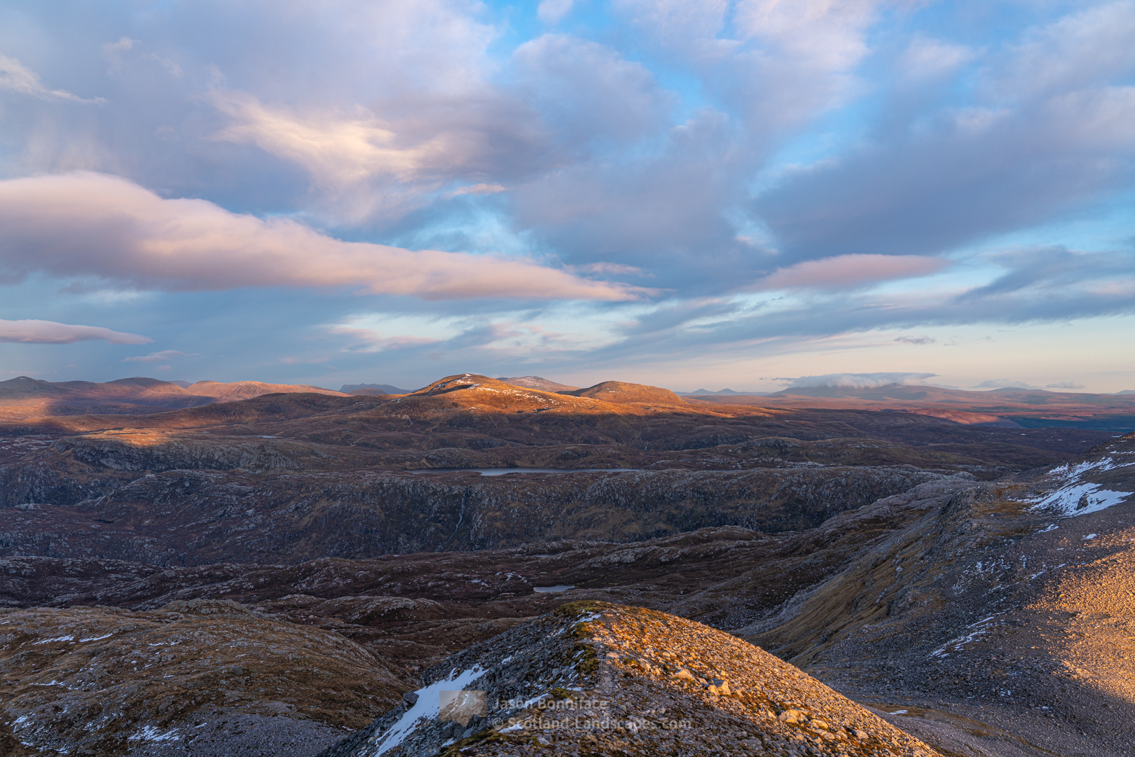
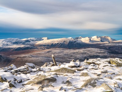
These hills are great view points to look into the remote area of eastern Assynt, from the head of Loch Glencoul to Beinn Uidhe and Ben More Assynt, and the watery head of Glen Cassley. They give fine views down the expanse of Loch Shin and across the Flow Country to Ben Klibreck, and of the Reay Forest hills to the north.
Read on to see and find out more about these hills or jump straight to one of the options below:

| Search for accommodation using Booking.com |
| Buy maps from the Ordnance Survey |
| Buy guide books and maps from Amazon |
Beinn Leoid and Meallan a’ Chuail
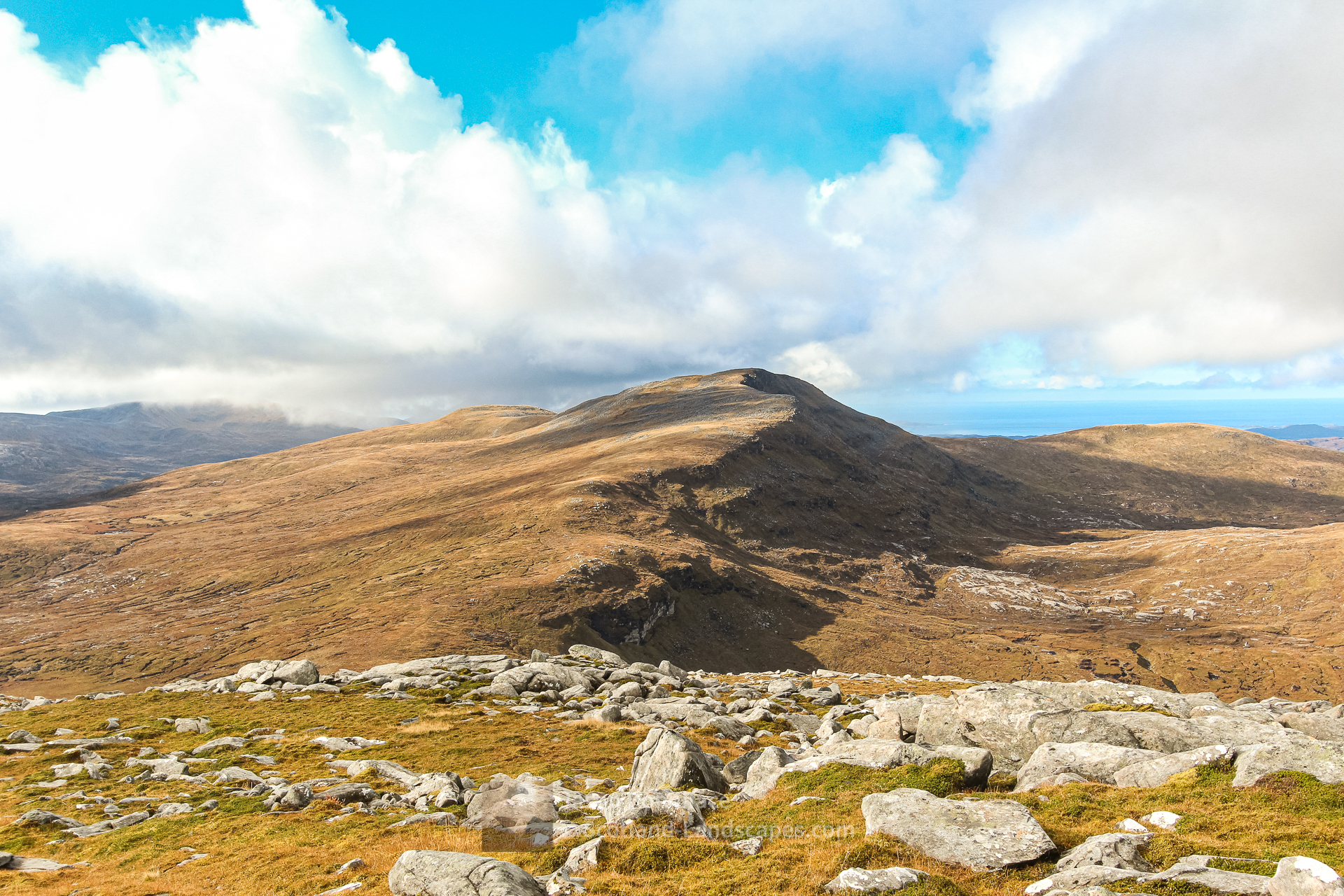


Table of Beinn Leoid and Meallan a’ Chuail summit details
| DoBIHID | Mountain | Height | Classification | Image 1 | Image 2 | Image 3 |
|---|---|---|---|---|---|---|
| 1189 | Beinn Leoid | 792m/2598ft | Corbett | Context Image | Detail Image | Summit Image |
| 1193 | Meallan a' Chuail | 750m/2461ft | Graham | Context Image | Detail Image | Summit Image |
Adapted from The Database of British and Irish Hills (DoBIH) under CC BY 4.0
Explore Beinn Leoid and Meallan a’ Chuail with the interactive map of the mountain, photos and indicative routes below. Click on a feature to see photos and more information; see a legend by toggling the side panel and switch layers on and off. View a larger map here. Please let me know what you think!
Interactive map of Beinn Leoid and Meallan a’ Chuail including the Corbett summit and photos
Important note: Routes on this map are provided as an indication only in good faith. They are approximate and indicative and should not be relied on for navigation or as a guarantee that any specific person will be capable of completing them. Read more
Climbing Beinn Leoid and Meallan a’ Chuail from the A838 west of Loch Merkland
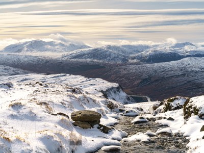
A stalkers path leaves the A838 road west of the head of the pass between Loch More and Loch Merkland. It winds steeply up hill to the flatter ground between Meallan a’ Chuail to the south and the smaller hills of Meall na Leithreach (566m) and Meall an Fheur Loch (613m). From here the north ridge of Meallan a’ Chuail is easily gained and can be followed easily enough over a couple of steeper steps to the summit.


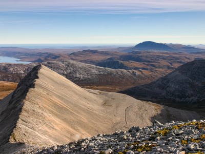
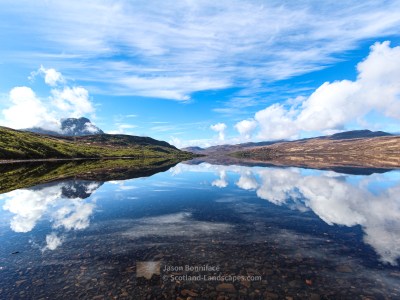
From the summit of Meallan a’ Chuail descend the westerly slopes to the Drochaid Beinn Leoid bealach, where another path climbs to the ridge, all the way from the shores of Loch Stack – I don’t know how good this path is but it is visible all the way on the OS Maps aerial photography. Then ascend the easy broad east ridge of Beinn Leoid to the summit.


Having come all this way it would be a shame not to visit Beinn Leoid’s south west top that overlooks the Stack of Glencoul and the remote ground over to Glas Bheinn and Beinn Uidhe in Assynt. If you do, you can avoid the re-climb back to the summit of Beinn Leoid by an easterly traverse of its southern slopes, back to the Drochaid Beinn Leoid bealach west of Meallan a’ Chuail.


View a single gallery of all Beinn Leoid and Meallan a’ Chuail images
Discover and explore more through the articles and links below.
| Search for accommodation using Booking.com |
| Buy maps from the Ordnance Survey |
| Buy guide books and maps from Amazon |
Northern Sutherland select photo gallery

Ben Hope – the most northerly Munro
The Foinaven and Reay Forest mountains
Distinct mountains of the Far North

Northern Sutherland
Foinaven and Arkle

Northern Sutherland interactive map

Beinn Leoid and Meallan a’ Chuail


Dun Dornaigil Broch and Strath More
Ard Neackie & Loch Eriboll
Loch Hope and the Hope to Altnaharra Road

Farr Bay, Bettyhill

Ceannabeinne Durness – Grey November Day but Still Beautiful

Ben Hope Summit Camp

Leave a Reply