
The hamlet of Hope on the A838 (North Coast 500 route) is at the north end of Loch Hope. From here a tiny, charismatic, winding single track road runs to Altnaharra in the heart of the Flow Country – a distance of 30 kilometres or so through some of the most remote and wild country in the British Isles. This is a very small, grass down the middle, single track road with mostly grass covered passing places. In winter it is not gritted or ploughed and can be “interesting” or even impassable. In summer the road has become quite popular and you should be prepared to meet oncoming traffic and select passing places. It is not suitable for large vehicles and should be driven with care and consideration. That said, it is an amazing route through great country.
| Search for accommodation using Booking.com | Buy guide books and maps from Amazon |
| Buy maps from the Ordnance Survey | Check out reviews at TripAdvisor |
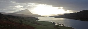
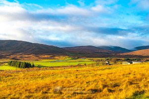
Loch Hope runs north – south for 10 kilometres and the roads wends its way above on the east side across moorland and through lovely birch woodland. There are numerous opportunities to pull up and get the views in the ever changing light.


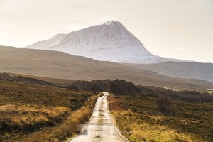
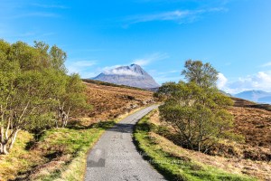


At the southern end of the loch the ramparts of Ben Hope close in and the glen narrows into Strath More. Here the Moine Path heads away from the road to the north east over the moorland of the Moine peninsula (A’ Mhoine) towards the head of the Kyle of Tongue. I have not followed this route for any great distance but it is likely a lovely rough walk. It is also a useful start for an approach to the north ridge and north western slopes of Ben Hope.
Strath More is best known as the starting point for the climb of the most northerly Munro, Ben Hope and for Dun Dornaigil broch. The car park and start of the path to Ben Hope are 2.5 kilometres north of the broch – at Muiseal which consists only of a barn and the parking area. Read more about the Dun Dornaigil Broch and Strath More here.
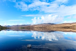
A couple of kilometres south of Dun Dornaigil Broch, Strath More veers westwards and the road to Altnaharra climbs away to the south east up on to the plateau of the Flow Country. A track leaves the road and gives access back to the upper strath, Gobernuisgach Lodge and beyond Glen Golly and the hills of the Reay Forest, including the Corbetts: Meall Horn, Meallan Liath Mhic Dhughaill and Ben Hee. This is a wild area well worth exploration.


The road continues to the south east over the moorland, past the southern tip of Loch Meadie, and then descends towards Altnaharra past the wonderfully named Chicken Dhu plantation. Here a path can be followed to distant Ben Hee. I had a good, but somewhat masochistic and wet boggy day climbing Ben Hee from here circa 2010. The camera got wet along with everything else and the photos are not usable! Beyond, the estate buildings at Mudale are the first civilisation for some time and the views to Ben Klibreck can be spectacular.


Purchase prints of photos in a wide range of sizes and media at my online store at Redbubble.

Discover and explore Northern Sutherland through the articles and links below.
| Search for accommodation using Booking.com | Buy guide books and maps from Amazon |
| Buy maps from the Ordnance Survey | Check out reviews at TripAdvisor |

Ceannabeinne Durness – Grey November Day but Still Beautiful

Ben Hope Summit Camp
