
For the last weekend in August we decided to head west with vague ideas of walks and cycles in the Torridon and Gairloch area. We didn’t have any plan, other than to make the most of the late summer weekend and decent weather forecast. As it turned out we had a spectacular time exploring several spots that were new to us and spotting a great variety of wildlife. Over the course of the weekend we visited the Victoria Falls and Slattadale on Loch Maree; the Rubha Reidh headland on the coast near Gairloch; and the glen of the Abhainn Bruachaig, Srath Chrombaill and Gleann na Muice near Kinlochewe. You can search for accommodation in Kinlochewe, Gairloch or Poolewe, all are perfect locations to stay to explore this wonderful area.
Scroll down to read on or jump to one of the options below:

| Search for accommodation using Booking.com |
| Buy maps from the Ordnance Survey |
| Buy guide books and maps from Amazon |
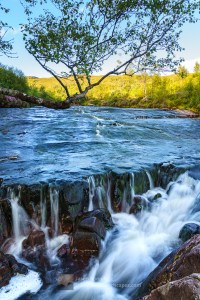
Victoria Falls
Saturday morning was bright and mild and the first stop was the Victoria Falls. These waterfalls are on the Abhainn Garbhaig stream just east of Slattadale on the southern side of Loch Maree, right on the A832 main road (part of the North Coast 500 route). After the relatively dry August the stream was quite low but in the morning light the falls were good to explore for a few minutes until the midges came out in full force.


Interactive map of the Gairloch to Kinlochewe area and photos
Important note: Routes on this map are provided as an indication only in good faith. They are approximate and indicative and should not be relied on for navigation or as a guarantee that any specific person will be capable of completing them. Read more here.
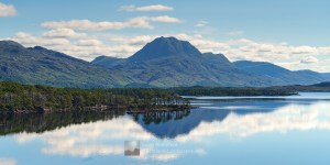
Slattadale and Loch Maree
Escaping the midges with the windows down to blow them out of the van, we made the short hop along the main road and down the small single track side road to Slattadale on the shore of Loch Maree, yet to develop any plan for the day. Breakfasting at one of the picnic tables was a joy as the midges just about stayed away and the views were spectacular. The water looked very inviting as a father and son paddled off towards the stunning Loch Maree Islands – part of the Beinn Eighe and Loch Maree Islands National Nature Reserve. The pine trees on the islands are a wonderful remnant of the ancient Caledonian pine forest.


We spoke to the friendly and knowledgeable lady from Forestry and Land Scotland who arrived to check on the car park and facilities. She recommended a wander north on the Slattadale to Tollie path that runs parallel to the shore of Loch Maree. Sun cream and insect repellent applied we decided to take a look. Out of woodland shade it was warm going in the hot sun but the changing views as we moved north were grand. A plethora of insects were out and about and the dragon flies in particular caught our attention; they are beautiful and impressive creatures. I got photos of Golden-ringed dragonfly and a red dragonfly that would seem to be either a male Ruddy Darter or a male Red-veined Darter – the British Dragonfly Society’s website was very useful getting that far.


We turned back for Slattadale at the point where the path climbs up north west away from Loch Maree, deciding that an afternoon down on the coast near Gairloch would be good. We did manage to make a bit of a circuit by using the forestry track south from An Doire, and a cut through path not on the current OS map, to return to the Slattadale car park.
Rubha Reidh headland
The Rubha Reidh is a large headland north west of Gairloch with a single track road up its west coast that gets progressively smaller all the way to the Rubha Reidh Lighthouse (also known as Rua Reidh), particularly after the settlement of Melvaig (not recommended for large vehicles beyond here). By the time we stopped a little after Melvaig the weather was deteriorating from the south west with Skye’s Black Cuillin, about 60 kilometres away, beginning to be swallowed by cloud.


Dolphins
After a very late lunch we cycled along to the lighthouse and soon realised that a few people had spotted dolphins off the point. They were moving east round the coast rapidly, whilst also having a fun time by the looks of things. Note to self: must invest in a bigger lens for nature photography when funds allow! The coastal scenery east from the point is good and the views to the hills of the far north west excellent; Foinaven was still in sun about 70 kilometres to the north.

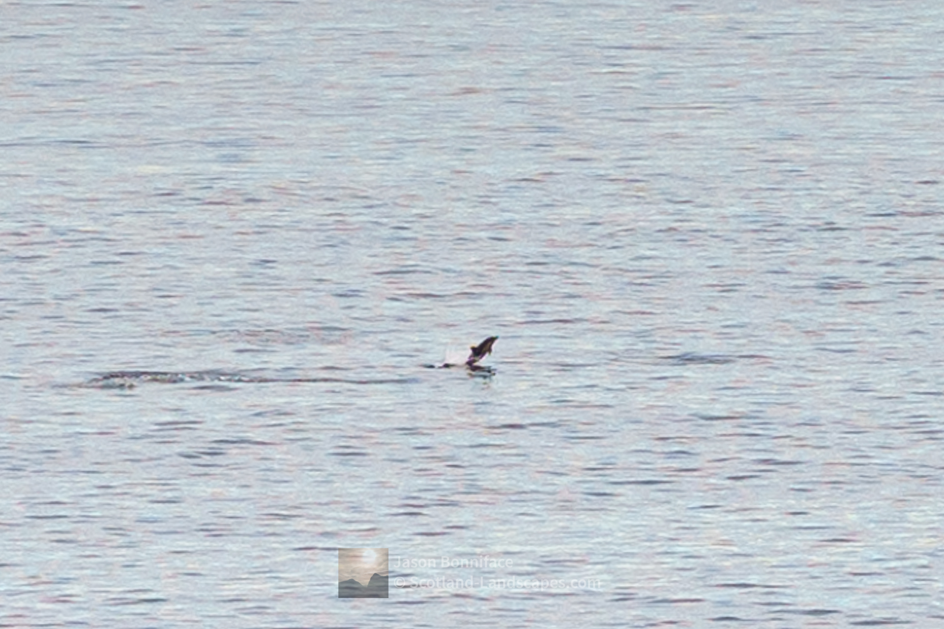


Whales
As we headed back past the lighthouse after exploring the point, we realised there was more going on in the sea. Turning round to look we couldn’t believe our eyes to see a couple of whales with one tail slapping the sea several times.

Whale tail slapping – at Rubha Reidh point – 1 
Whale tail slapping – at Rubha Reidh point – 2 
Whale tail slapping – at Rubha Reidh point – 3 
Whale tail slapping – at Rubha Reidh point – 4 
Whale tail slapping – at Rubha Reidh point – 5 
Whale tail slapping – at Rubha Reidh point – 6 
Whale tail slapping – at Rubha Reidh point – 7 
Whale tail slapping – at Rubha Reidh point – 8 
Whale tail slapping – at Rubha Reidh point – 9 
Whale tail slapping – at Rubha Reidh point – 10 
Whale tail slapping – at Rubha Reidh point – 11


As we cycled back towards Melvaig the light began to fade and the weather closed in. Delighted with our day, we settled in for the evening.
The southern fringe of the Letterewe and Fisherfield Forests – Abhainn Bruachaig, Srath Chrombaill and Gleann na Muice
Sunday morning brought the delightful sight of wall to wall mizzle – at its hardest it was of the quickly drenching sort. The forecast was more promising inland so we headed back through Gairloch and up Loch Maree to Kinlochewe, and then to the car park at Incheril nearby. As forecast, the mizzle had dried up inland and we decided on an afternoon exploration of the glen of the Abhainn Bruachaig river that heads east then north east from Incheril. I’ve looked at the track up this glen for many years on the map and never got round to exploring in person. As with many other glens a new, relatively small scale, hydro electric scheme has recently been constructed and there are signs of both decay and renewal.


Beyond the modern house at what is marked as the Heights of Kinlochewe on the OS maps (I think the name Heights of Kinlochewe really applies to the high ground to the west and north west of here?), the glen branches into Gleann na Muice and Srath Chrombaill. In turn a little further up Srath Chrombaill, Gleann Tanagaidh also branches off – it leads up to the feet of modest but remote Beinn Bheag (668m) and Groban (749m) that lie in the country between the high Fannichs to the east and Mullach Coire Mhic Fhearchair to the west – remote country.
Srath Chrombaill
Srath Chrombaill heads east, beneath the northern aspects of the Achnasheen Munro Fionn Bheinn, its head waters quite close to Loch Fannich. A track leads 3 kilometres or so up to the open, dilapidated, cottage at Leckie where there are also ruins and scenic views to Fionn Bheinn. New hydro plant has been installed just upstream.


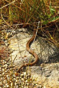
Gleann na Muice – with an adder and a toad
Gleann na Muice heads north north west up to the high ground at the south end of the Letterewe Forest’s Lochan Fada (the biggest lochan I can think of at about 5 kilometres long). A track also heads up this glen becoming a path higher up after an off shoot heads up north onto Meallan Odhar above. The path joins the Gleann Bianasdail route past Slioch at the end of Lochan Fada and is a good alternative approach into the Letterewe and Fisherfield Forests.
On the way up the glen we were very close to standing on an adder as it slid across the track. I suspect all parties were pleased that standing on was avoided.


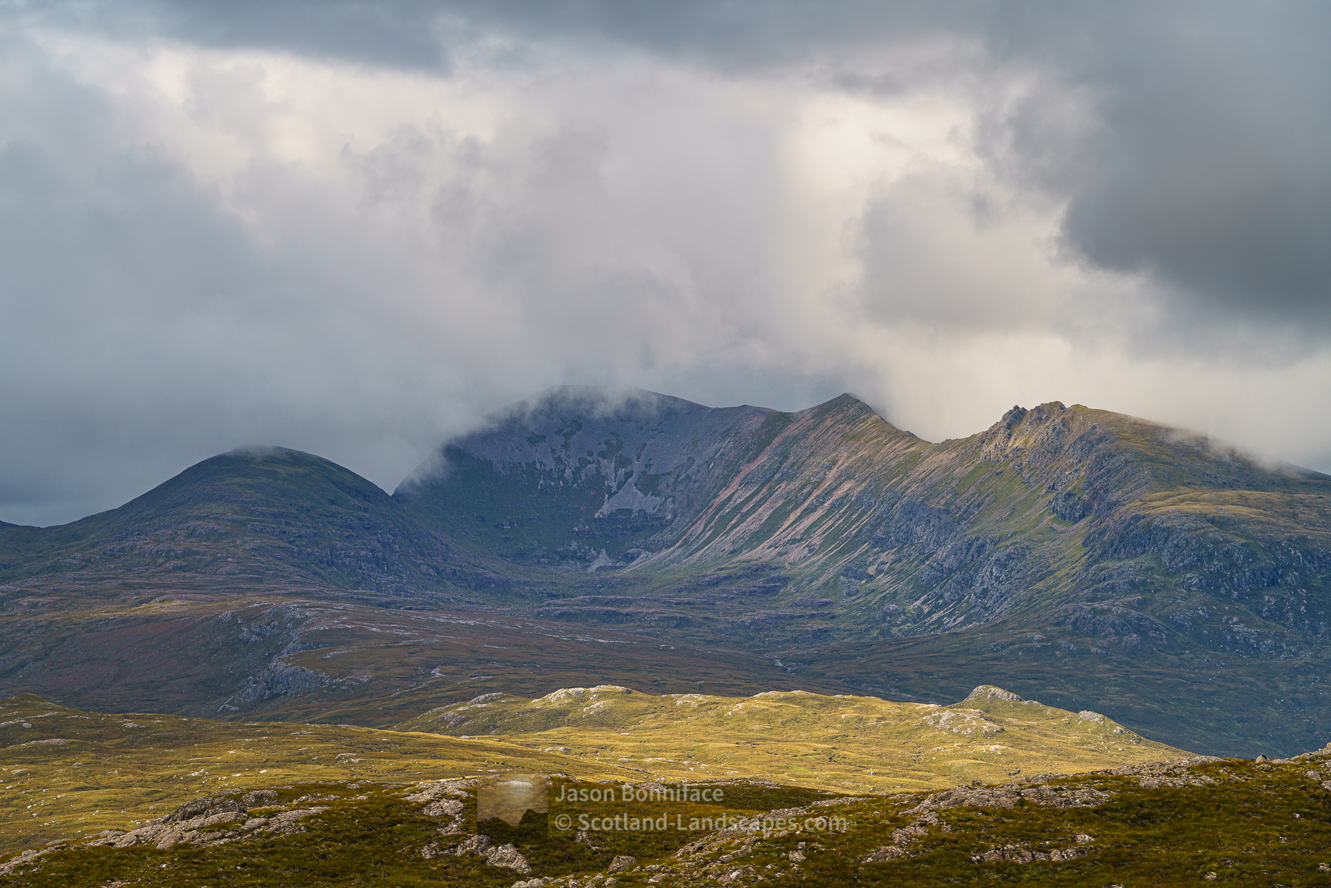
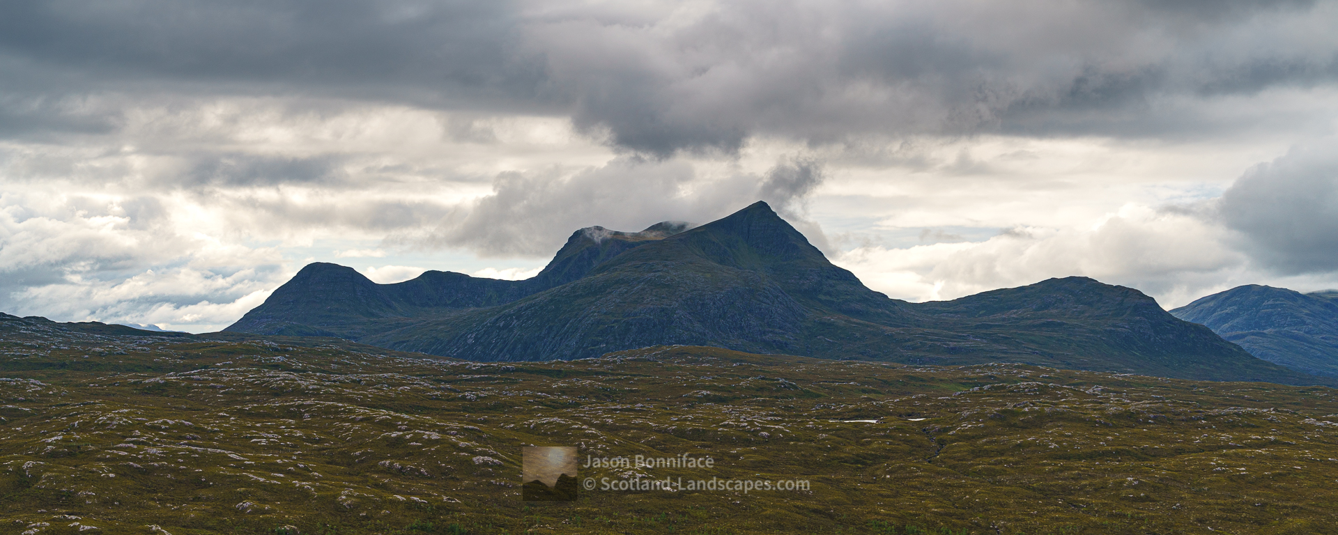
Higher up we aimed for Meallan Odhar, a very modest 410 metre hillock above the glen that we thought would gives us some fine views into the Letterewe and Fisherfield Forests – we weren’t disappointed. It was superb just to be on the edge of this rough and remote country looking in. It’s been too long since we were last in the thick of it.
The view of Slioch’s eastern aspects are seldom seen, the classic view being from the west, from the shores of Loch Maree. Lochan Fada can only be seen by getting well away from any roads into this wild country. Mullach Coire Mhic Fhearchair, with its subsidiary tops, is a bit of a local giant and is well seen from Meallan Odhar.


Soon we had to head back down to the glen and out to Incheril and Dingwall, only one of us having the Monday off. I was the lucky one with my sights on a cycle into the Sutherland Munro Seanna Bhraigh from Strath Oykel. A day that also turned out to be one to savour.

View a gallery of all post images
Discover and explore more through the links and articles below.
| Search for accommodation using Booking.com |
| Buy maps from the Ordnance Survey |
| Buy guide books and maps from Amazon |

Beinn Eighe – Ruadh-stac Mor and Spidean Coire nan Clach

Liathach – Spidean a’ Choire Leith and Mullach an Rathain

An Teallach

Ben Hope – the most northerly Munro
Foinaven and Arkle
Leave a Reply