At the end of November and start of December the western Highlands enjoyed a period of mostly cold, clear, bright weather as high pressure was in charge. Luckily I was in Lochaber and managed a few days out wrapped around the working week.
Gaor Bheinn (Gulvain) and Braigh nan Uamhachan
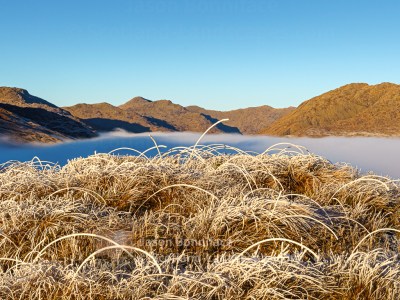
The first Saturday of the period gave me the opportunity to visit the Munro Gaor Bheinn, better known by the anglicised Gulvain, and its neighbouring Corbett Braigh nan Uamhachan.
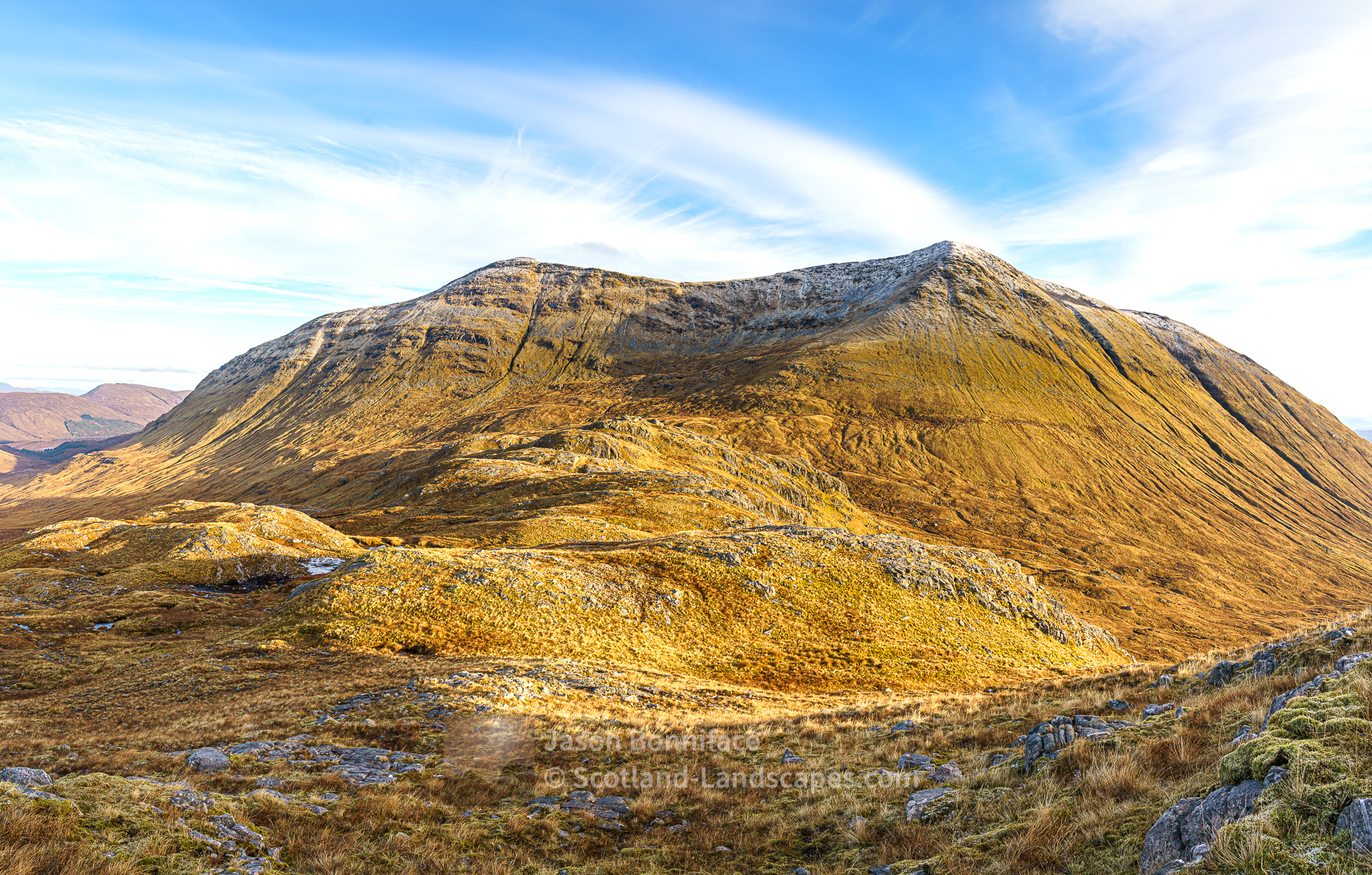
For me this was a second visit to Gaor Bheinn, and a first to Braigh nan Uamhachan as I make a concerted effort to explore the Corbetts. The hills are located towards the east of the group that I’m calling Morar to South Loch Arkaig. They’re north east of Glenfinnan, between the western ends of Loch Eil to the south and Loch Arkaig to the north. They are most easily reached via Gleann Fionnlighe, up which there is a track and then path (becoming rougher and wetter up the glen), to the foot of Gaor Bheinn and then a rough unmarked hill path up the south ridge. Views on the summit ridge of Gaor Bheinn were initially obscured by rising valley mist but I waited a while on the main summit (the north top) and was fortunate to witness the mist clearing away in the bright, low sun to reveal stunning views in all directions. Ben Nevis and its neighbours to the east, the Ardgour hills to the south – Sgurr Dhomhnuill (Ardgour’s highest point at 888m), Garbh Bheinn and Sgurr Ghiubhsachain prominent, Streap and Sgurr Thuilm to the west and the Glen Dessarry and Knoydart hills with the Skye Cuillin peaking up unmistakeably behind to the north west.
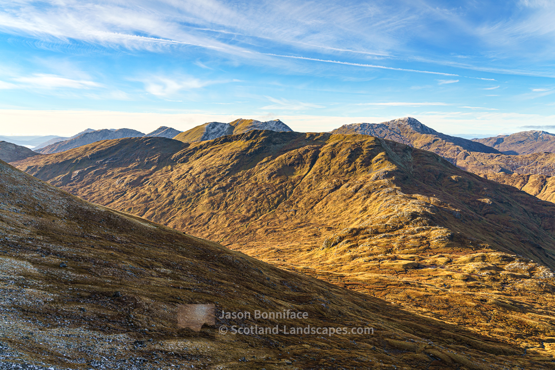
The afternoon was spent making my way over to Braigh nan Uamhachan and then south along its long ridge, enjoying the changing light as the sun began to descend in the south west behind the Ardgour hills.


| Search for accommodation using Booking.com |
| Buy maps from the Ordnance Survey |
| Buy guide books and maps from Amazon |
Cona Glen and the south Cona Glen ridge
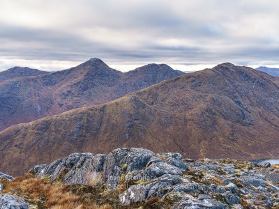
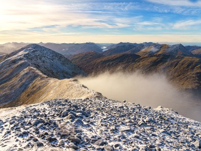
After four days of work at the computer, the following Friday looked promising and I nipped over the working again Corran Ferry to explore Cona Glen on the west side of Loch Linnhe north of Corran. The long glen leads west from Inverscaddle on Loch Linnhe and is probably best known as forming a large part of the first day of the Cape Wrath Trail when the route is tackled south to north.
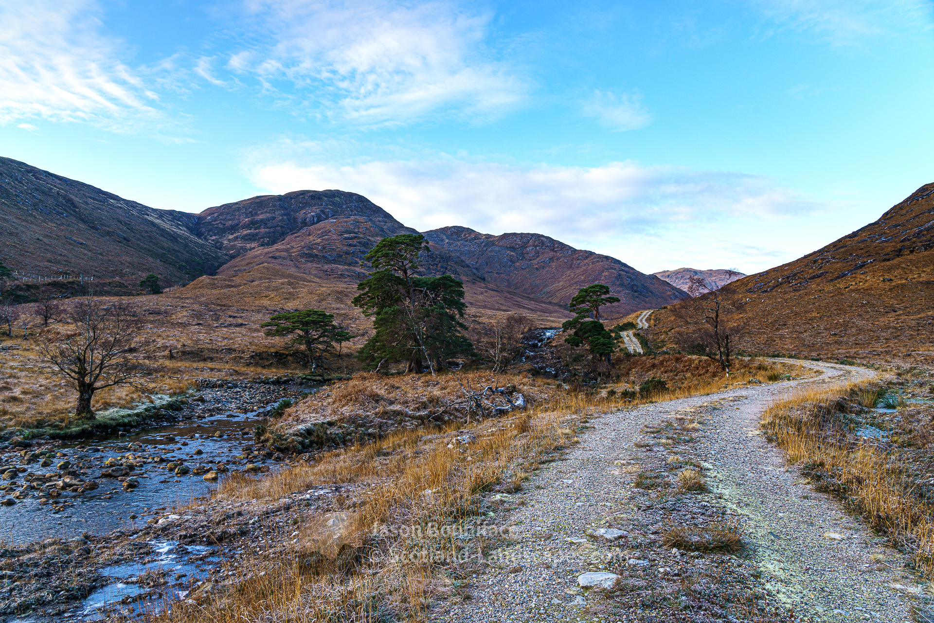


The aim was to cycle up the glen and then traverse the long ridge of hills on its upper southern side – culminating in the Corbett Stob a’ Bhealach an Sgriodain (aka Druim Tarsuinn), with a possible extension to take in the lovely Sgurr Ghiubhsachain at the head of the glen if energy and the short daylight hours allowed. In the event they did, just, sort of. The traverse of the ridge was a pleasure, if an up and down one over the several tops. I reached the summit of Sgurr Ghiubhsachain in gathering dusk and pink hazy light over Ben Nevis but didn’t linger. The descent to the path at the bealach south of Sgorr Craobh a’ Chaorainn was relatively easy, only the last part requiring the headtorch. A very dark walk then cycle back down the glen ensued with just my patch of light on the track ahead for the 13 kilometres or so.


Walking at Callop on the Cape Wrath Trail
Later in the weekend we walked at a mist enveloped Callop near Glenfinnan, just over the ridge from Cona Glen, on the route taken by the Cape Wrath Trail as it descends north to Callop. After a week of hard frosts the ground was frozen solid and much of the path covered by water ice. We enjoyed a careful wander through the frost encrusted heather and pines and on up in to the sun above the mist on the path towards Cona Glen. We were grateful for the warmth of even the low December sun once we reached it.


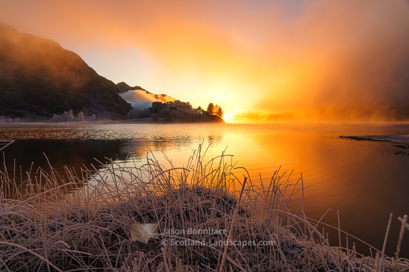
After descending back in to the gloomy afternoon mist we headed the couple of kilometres west to Glenfinnan. As we rounded the wooded bends at the north east end of Loch Shiel we were amazed by the intense orange glow of the low sun shining through the mist from the south west.
Glenfinnan – afternoon light
In 1745 Highlanders gathered at Glenfinnan in support of “Bonnie Prince Charlie” and the Jacobite uprising that aimed to restore the Stuarts to the thrones of Scotland and England. The Jacobite forces were eventually beaten at Culloden, close to Inverness, and the prince fled in an apparently epic escape via Skye to live out his days in the milder, drier climes of France and Italy. The Glenfinnan Monument was built in 1815 to commemorate the support and sacrifice of the Highland clans. These days Glenfinnan is also famous for its rail viaduct that featured memorably in the Harry Potter films.


Find out more about purchasing from Redbubble here.
Discover and explore Morar, Moidart, Ardgour, Ardnamurchan and Morvern through the articles and links below.
| Search for accommodation using Booking.com |
| Buy maps from the Ordnance Survey |
| Buy guide books and maps from Amazon |

Morar, Moidart, Ardgour, Ardnamurchan and Morvern

Fort William, Ben Nevis and Glen Coe

Morar, Moidart, Ardgour, Ardnamurchan and Morvern select photo gallery
Morar to Loch Arkaig mountains
Ardgour mountains
Gaor Bheinn (Gulvain) and Braigh nan Uamhachan

An ascent of Beinn Odhar Bheag and Beinn Mhic Cedidh graced by a white tailed eagle flyby

A visit to the Silver Sands of Morar at Camusdarach, Loch Morar and Stoul on Loch Nevis, and lovely winter light

Leave a Reply