Nestled in the west between the Fort William area to the south, Torridon to the north, and the Isle of Skye to the west, is a rugged land of mountains, lochs and coastlines. The mountains are of a different character to those of Torridon to the north and Skye to the west as the geology is different – being dominated by metamophic rocks lying to the east of the Moine Thrust. In the north of the area are the settlements of Kyle of Lochalsh, Plockton and Lochcarron. The bridge to Skye is at Kyle of Lochalsh, as is the rail terminus for the line from Inverness; so Kyle is an important, if small, hub in the west and an ideal location from which to explore the area. You can search for accommodation here.
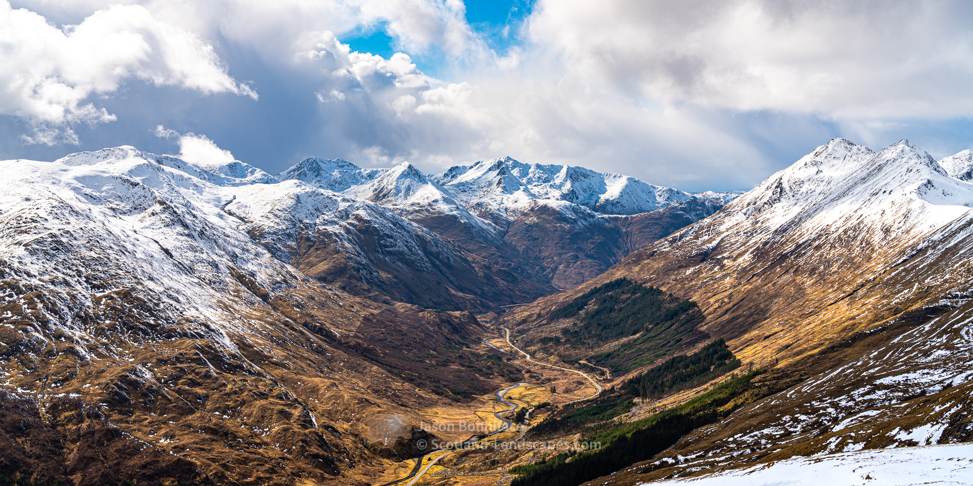
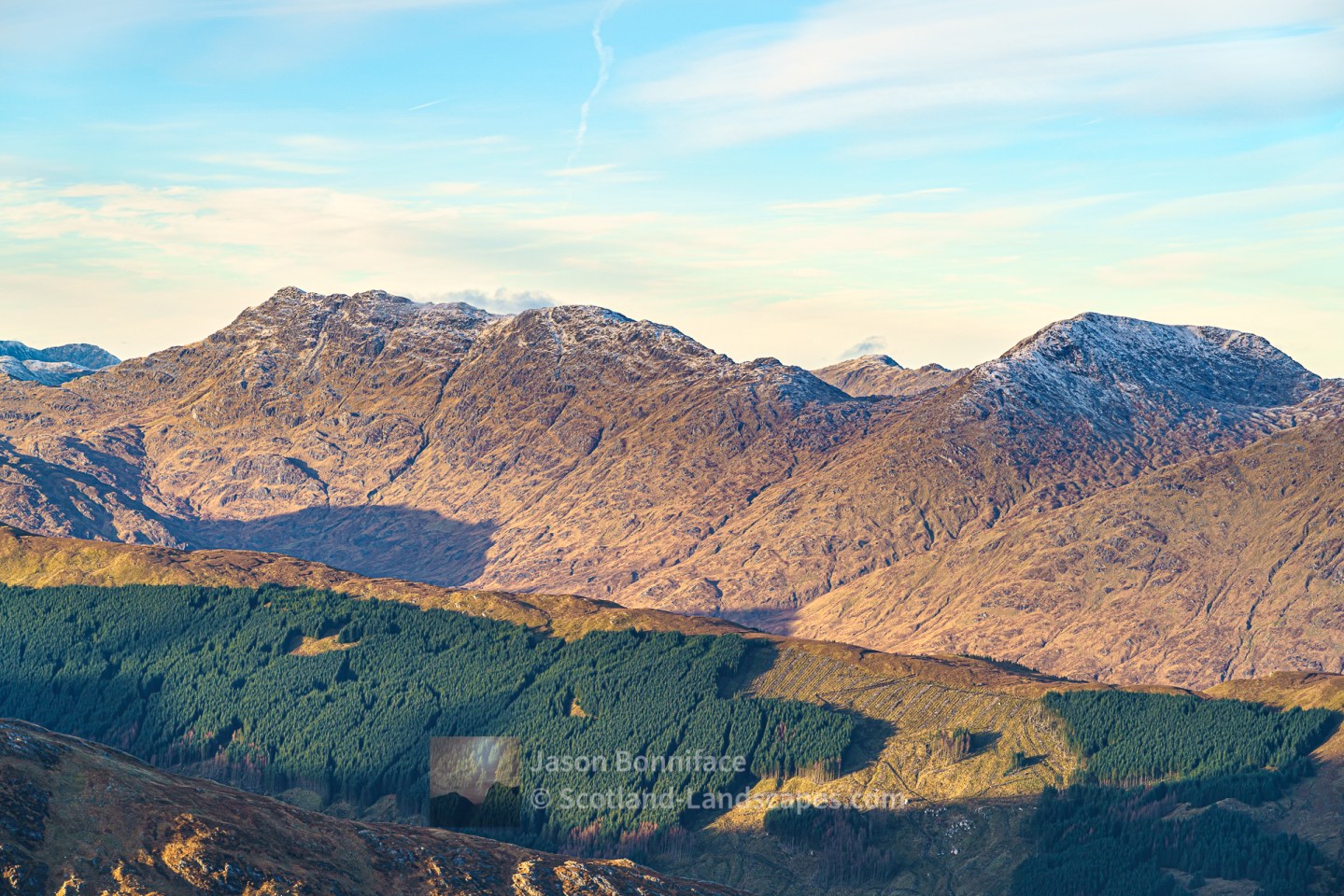
The A87 road to Kyle of Lochalsh passes along Loch Cluanie and through Glen Shiel en-route to Kyle of Lochalsh and the bridge to Skye. Either side of this road are high mountain ridges with many Munro summits; the stunning Eilean Donan castle juts out into Loch Duich close to the road at Dornie and is a very popular attraction. To the north a number of glens have paths through to the remote inland areas of Glen Affric, Loch Mullardoch and Loch Monar, and the Cape Wrath Trail passes this way through Shiel Bridge and Morvich. The Falls of Glomach are remote waterfalls with one of the highest drops in Britain of 113 metres.


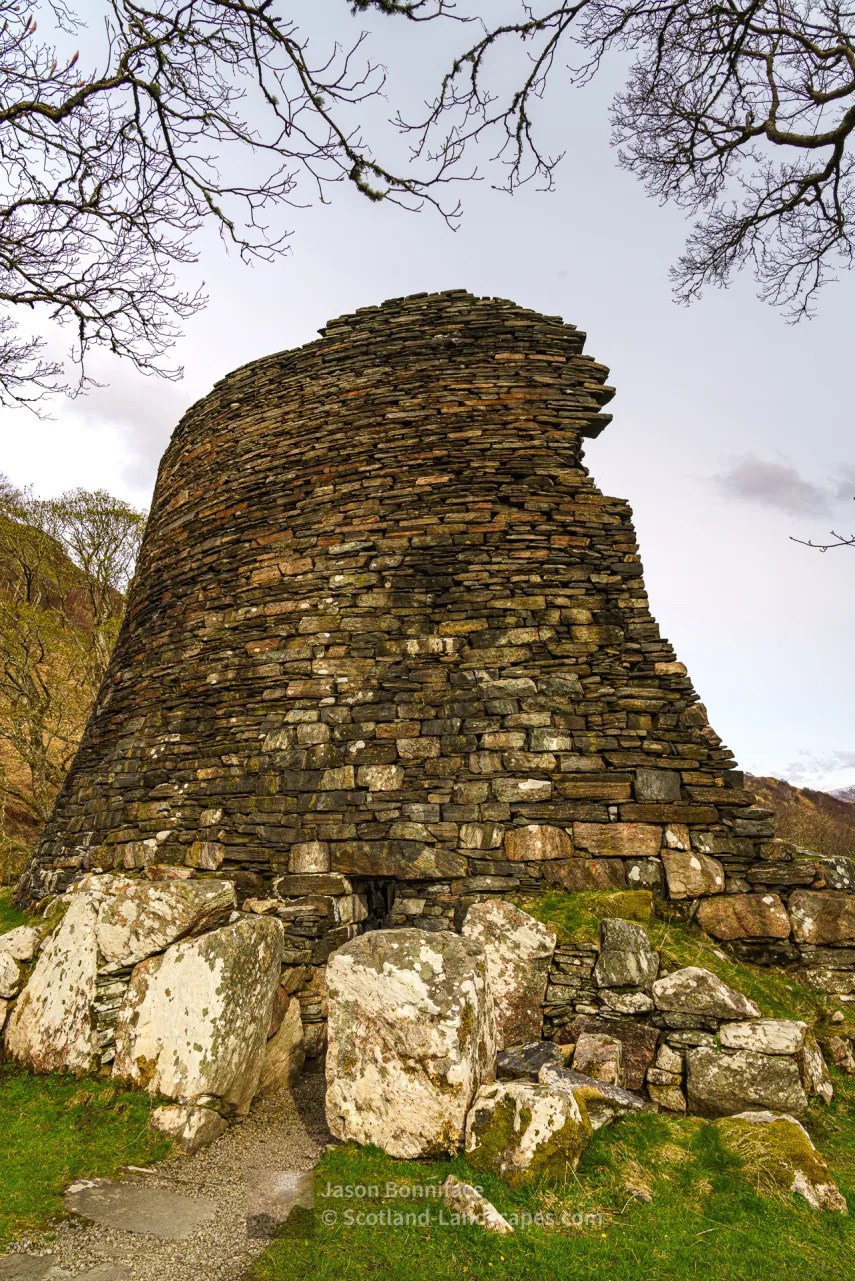
West of Shiel Bridge a small road winds high over the Mam Ratagan pass and down to the tranquil village of Glenelg on the shores of the Sound of Sleat opposite the Isle of Skye. Glenelg has a rich history and is a long standing crossing point to Skye, the Glenelg-Skye ferry still operates from April to October across the Kyle Rhea narrows. Glenelg has three Iron Age brochs, Dun Telve, Dun Troddan and Dun Grugaig (a prototype semi-broch). Dun Telve and Dun Troddan are among the best preserved in Scotland. South of Glenelg the scenic road runs to lovely Arnisdale on the shores of Loch Hourn.


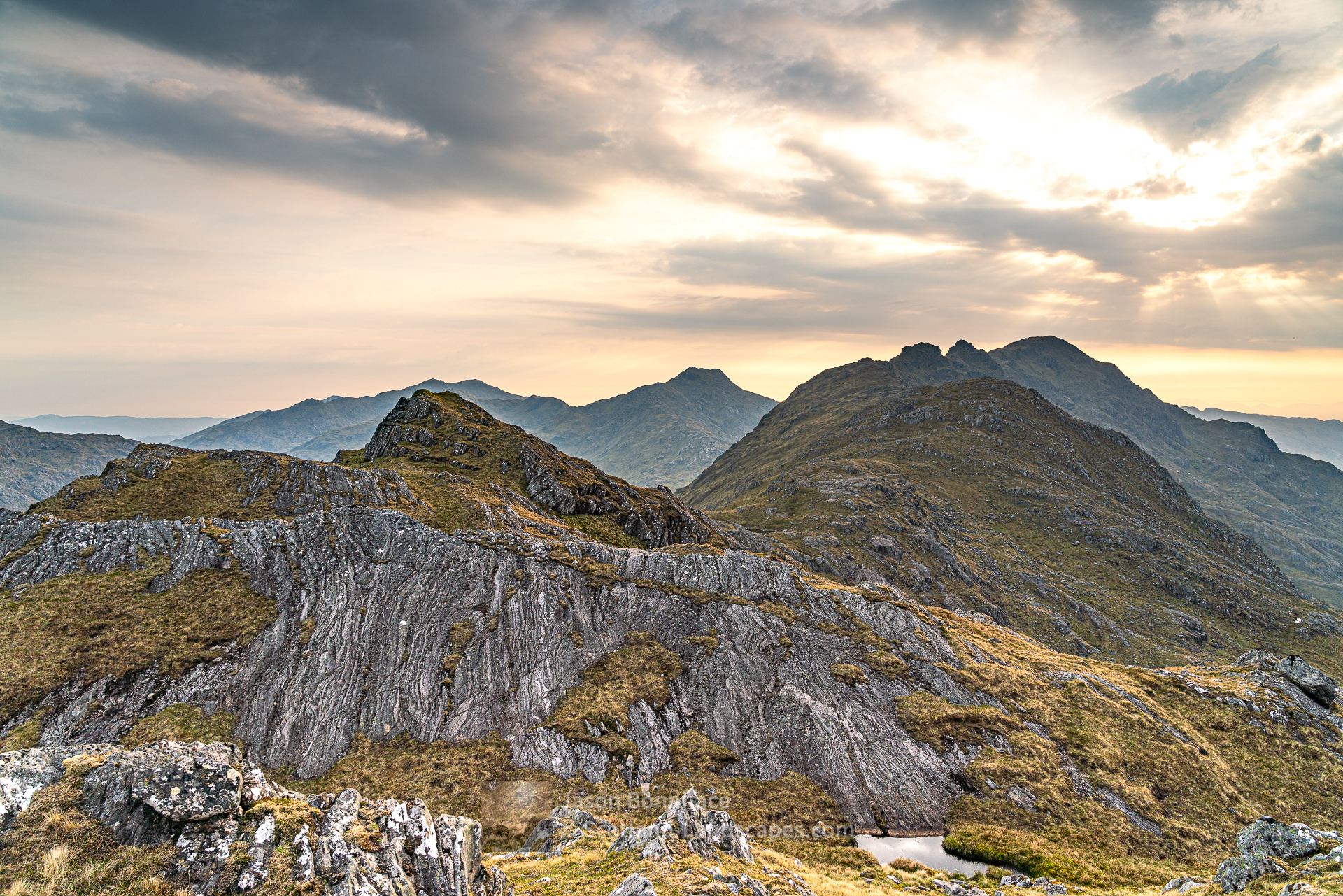
In the south of the area Knoydart is a celebrated wild and remote peninsula between the sea lochs of Loch Hourn in the north and Loch Nevis in the south. Knoydart can only be accessed by foot or by boat. Along with the mountains south of Loch Cuaich (Quoich) and west of Loch Arkaig, it is one of the most iconic wild areas of Scotland, the “Rough Bounds of Knoydart”.


Discover and explore Lochalsh and Knoydart through the articles and links below.
| Search for accommodation using Booking.com |
| Buy maps from the Ordnance Survey |
| Buy guide books and maps from Amazon |
Lochalsh & Knoydart select photo gallery

Lochalsh & Knoydart Interactive Map

Knoydart & South Loch Cuaich (Quoich) mountains

Kintail & North Glen Shiel mountains

Beinn an Aodainn (Ben Aden)

Sgurr a’ Choire-bheithe
Sgurr na Ciche, Garbh Chioch Mhor and Sgurr nan Coireachan

A Bivvy Above Barrisdale – Sgurr a’ Choire-bheithe and Beinn an Aodainn (Ben Aden)
High quality prints of my images can be purchased in a wide range of sizes and media at my online store at Redbubble and are shipped globally.