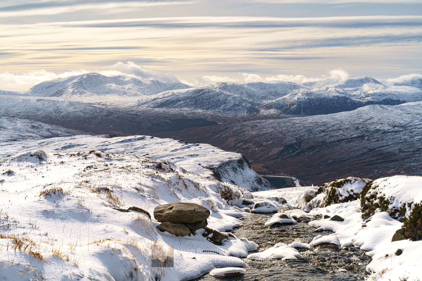
The group of hills comprising of Foinaven and the Reay Forest areas are exceptionally wild and remote and include the Corbetts: Foinaven, Arkle, Meall Horn, Meallan Liath Mhic Dhughaill, Ben Hee, Cranstackie and Beinn Spionnaidh. This is a great area, well worth exploration and much less frequented than either Ben Hope or the more popular Assynt hills. The group occupies a huge area between the A838 Lairg to Durness road in the west, and the A836 Lairg to Tongue and Altnaharra to Hope roads in the east, with several main access points around these roads. Accommodation can be booked in the Durness, Tongue or Lairg areas, any of which are ideal locations for exploring the area.
A track between Allnabad, on the Altnaharra to Hope road, and West Merkland traverses the range between Ben Hee and Beinn Direach over the Bealach nam Meirleach providing good access to the southern hills.
The A838 gives access to Ben Hee from West Merkland; Meallan Liath Mhic Dhughaill from Kinloch; Arkle and Meall Horn from near Achfary; Foinaven from Gualin House between Rhiconich and Durness; and Cranstackie and Beinn Spionnaidh from either Rhigolter or Polla.

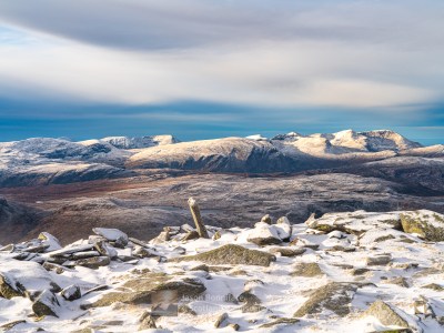
Foinaven and Arkle
Explore Foinaven and Arkle with the interactive map of the mountain, photos and indicative routes below. Click on a feature to see photos and more information; see a legend by toggling the side panel and switch layers on and off. View a larger map here. Please let me know what you think!
Interactive map of Foinaven and Arkle including the Corbett summit and photos
Important note: Routes on this map are provided as an indication only in good faith. They are approximate and indicative and should not be relied on for navigation or as a guarantee that any specific person will be capable of completing them. Read more


Purchase prints of photos in a wide range of sizes and media at my online store at Redbubble.

Discover and explore more through the articles and links below.
| Search for accommodation using Booking.com |
| Buy maps from the Ordnance Survey |
| Buy guide books and maps from Amazon |

Ceannabeinne Durness – Grey November Day but Still Beautiful

Ben Hope Summit Camp
