
In recent news Mountaineering Scotland has highlighted an issue of Google Maps indicating a route to the summit of Ben Nevis from the Glen Nevis upper car park, see the Mountaineering Scotland article here. The route indicated by Google crosses pathless, difficult, and potentially dangerous terrain. It is not a route that anyone with knowledge would suggest as a good route to others.

Google Maps Screenshot – Ben Nevis 
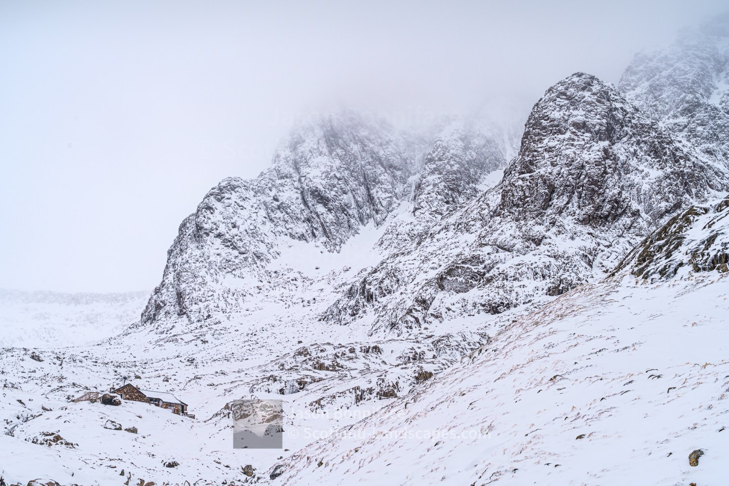
The South Side of Ben Nevis 
The Ground Above the Glen Nevis Upper Car Park
To be clear, the only straight forward walking route to the summit of Ben Nevis is in summer via the well worn path from Achintee, just two kilometres from the mini roundabout in Fort William, much lower down Glen Nevis. High up, snow may be encountered well into the summer and at any time out-with.
The thought of relying on Google Maps at the present time for route suggestions and navigation on Scotland’s mountains is a worrying one for reasons including the following:
- Google Maps appears to be using an algorithm to suggest a short route to the summit of Ben Nevis that seems to take no account of terrain.
- The Google Maps default base map might be adequate for navigating on roads but it is poor in terms of the detail of the natural terrain.
- The Terrain layer and Satellite imagery map offer some enhancement to the default but are not detailed enough for anything but an indication.
- Paths marked on Google Maps appear to be inconsistent and incomplete.
- Relying solely on electronic devices carries some risk – most obviously of running out of battery – but is only likely to become more common and is an option with other mapping as well.
So which maps should be used on Ben Nevis, other Scottish mountains and in the Scottish outdoors generally? Below I give my opinions based on extensive use. In addition to using maps, guide books are massively useful in suggesting and describing routes in the outdoors.
Please note, this post contains affiliate links to products sold by the following organisations: Ordnance Survey, Amazon and Waterstones. If you click on a link and make a purchase I may, at no additional cost to you, earn a commission. This helps me to fund the maintenance and development of this site. Thank you!
Ordnance Survey (OS) Mapping
The Ordnance Survey (OS) are the national mapping agency for Great Britain. Given the high quality and authoritative nature of Ordnance Survey mapping of the British Isles, it is difficult to see past OS maps as the primary recommendation. Here I will note that the only maps I frequently use in the British Isles are OS maps, both in paper form, and digital using OS Maps Premium. This is available both on desktop and via the OS Maps app. The reason I use OS mapping is that to my mind it offers the most clear and accurate mapping available for the British Isles; also the whole country is covered at consistent scales and quality.

OS Explorer maps are at 1:25,000 scale (4cm=1km) and are ideal for hill walking, Munro bagging and other outdoor pursuits. I recommend these maps for use in the hills and mountains and when there is a chance of going off marked paths and tracks.

OS Landranger maps are less detailed at 1:50,000 scale (2cm=1km) but are great for putting the wider landscape and peaks in context and are likely to be fine for following marked tracks and paths. The main issue with their use is when poor visibility conditions are encountered; reduced detail mapping makes navigation more difficult.

OS maps are available digitally here on both desktop and mobile via the OS Maps app. Standard free mapping is significantly more detailed than the Google Maps default map, and Terrain layer, but omits tracks and paths – of little use for hill walking. A premium subscription is offered at a reasonable price and gives access to OS Landranger and Explorer maps. The mapping displayed changes as appropriate with scale. Both the desktop service and OS Maps app are very good and there are additional options such as discovering routes recorded by others or adding your own.
Search for an OS map here on the OS website
OS maps are also available from retailers such as Waterstones and Amazon
Harvey Maps
Harvey maps have been around since the 1970s and are the main competitor to the OS in terms of maps for outdoor pursuits. Harvey Maps make very good maps but they only cover certain areas of the country – the most popular mountain areas such as Ben Nevis, Glencoe and the Cuillin on Skye are well covered. Harvey maps are waterproof and probably harder wearing than standard OS paper maps. I’m not sure what they are made of but Harvey claim they are “100% waterproof, tough and light”. These are undoubtedly very good maps and are popular. There is no reason not to use these maps but personally I prefer the look and feel of the OS maps, particularly the 1:25,000 Explorer series. I have been known to enjoy a Harvey’s Mazzle (map jigsaw) though! Harvey maps are available direct from Harvey.
Harvey’s British Mountain Maps are at 1:40,000 scale, so still fairly detailed and likely to cover a larger area than the Superwalker 1:25,000 equivalent.
Superwalker maps are at 1:25,000 scale, ideal for hill walking use. Harvey also do a “Summit” series of maps at very large scale.
Harvey maps are also available from retailers such as Waterstones and Amazon
More from Scotland-Landscapes.com
An ascent of Beinn Odhar Bheag and Beinn Mhic Cedidh graced by a white tailed eagle flyby
A visit to the Silver Sands of Morar at Camusdarach, Loch Morar and Stoul on Loch Nevis, and lovely winter light
February days in Lochaber – an evening above Glen Coe, Glen Roy hills and a wander to the CIC Hut of Ben Nevis
Early winter days – the best of trips to Gaor Bheinn (Gulvain), Cona Glen, Callop and Glenfinnan

Whales, dolphins, dragon flies, an adder and more – all in a weekend of wanders near Kinlochewe and Gairloch

Christmas Eve on a cold and windy Beinn Enaiglair – A Corbett near Ullapool

Which Maps to Use in the Scottish Outdoors?

A Bivvy Above Barrisdale – Sgurr a’ Choire-bheithe and Beinn an Aodainn (Ben Aden)

Partial Eclipse 10th June 2021 – A Glimpse & Crazy Time for a Baby Deer

Leave a Reply