
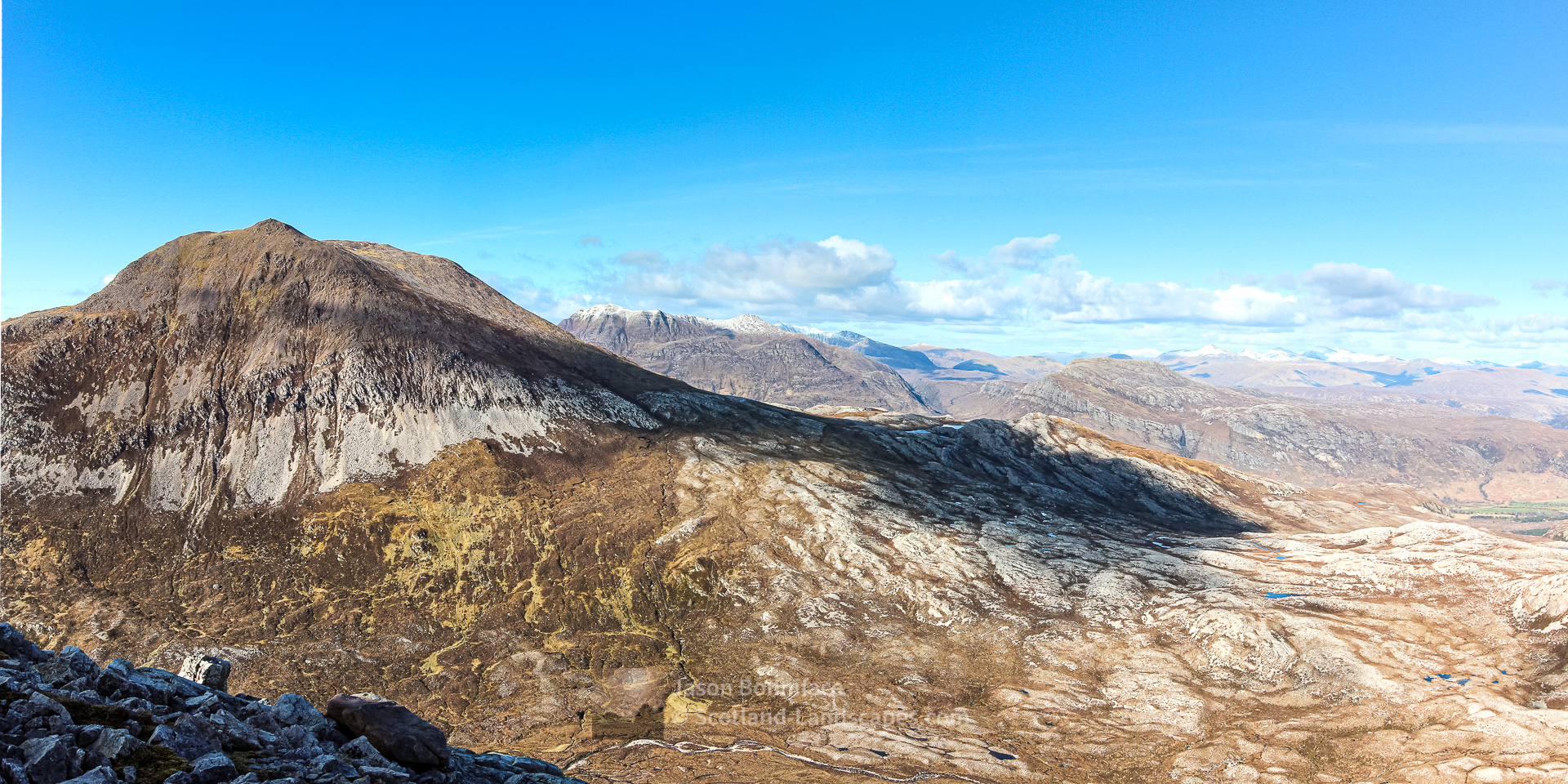
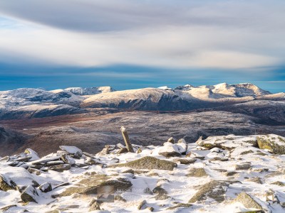
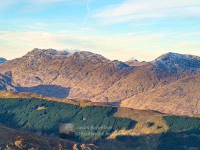
Meall a’ Ghiubhais (Meall a’ Ghiuthais on OS maps) is a Corbett close to the southern end of Loch Maree and is a great viewpoint for the loch, Beinn Eighe to the south and the hills of the Letterewe and Fisherfield Forests to the north. It is close to Beinn Eighe outlier and fellow Corbett Ruadh-stac Beag. The two hills can be combined to give a longer day. The mountain is best approached either from the Beinn Eighe Visitor Centre at Kinlochewe via the Pony Track or the Beinn Eighe “Mountain Trail” from the Coille na Glas-Leitir car park on the shores of Loch Maree about 2 kilometres north west of the visitor centre. The village of Kinlochewe is a perfect base for exploring this area – you can search and book accommodation here.
The mountain is within the Beinn Eighe National Nature Reserve, the first in the UK and now over 70 years old. It was originally protected to conserve and restore the ancient pinewoods and these can be enjoyed near the visitor centre at the start of the trail.
Read on to see and find out more about this excellent hill or jump straight to one of the options below:


| Search for accommodation using Booking.com |
| Buy maps from the Ordnance Survey |
| Buy guide books and maps from Amazon |
Meall a Ghiubhais


Table of Meall a’ Ghiubhais details
| DoBIHID | Mountain | Height | Classification | Image 1 | Image 2 | Image 3 |
|---|---|---|---|---|---|---|
| 972 | Meall a' Ghiubhais | 887m/2910ft | Corbett | Context Image | Detail Image |
Adapted from The Database of British and Irish Hills (DoBIH) under CC BY 4.0
Explore Meall a’ Ghiubhais with the interactive map of the peaks, photos and indicative routes below. Click on a feature to see photos and more information; see a legend by toggling the side panel and switch layers on and off. View a larger map here. Please let me know what you think!
Interactive map of Meall a’ Ghiubhais including photos
Important note: Routes on this map are provided as an indication only in good faith. They are approximate and indicative and should not be relied on for navigation or as a guarantee that any specific person will be capable of completing them. Read more here.
Climbing Meall a’ Ghiubhais from Kinlochewe
The Beinn Eighe Visitor Centre is about one kilometre north west of the centre of Kinlochewe on the west side of the A832 Gairloch road (part of the North Coast 500 route). There is a good car park and a fine path winds through the woods to the south for several hundred metres before turning up hill towards the south west alongside the Allt Sguabaidh stream. This is the “Pony Track” which leads reliably about 4 kilometres up to the bealach between Beinn Eighe and Meall a’ Ghiubhais, the Drochaid Allt Toll a’ Ghiubhais.
From the bealach head northwards up gentle slopes before picking a line up the steeper south easterly aspect of Meall a’ Ghiubhais ahead. The summit (887m) is at the southern edge of the summit plateau. The most straight forward descent is likely to be by the ascent route described.


Discover and explore more through the links and articles below.
| Search for accommodation using Booking.com |
| Buy maps from the Ordnance Survey |
| Buy guide books and maps from Amazon |

Beinn Eighe – Ruadh-stac Mor and Spidean Coire nan Clach

Liathach – Spidean a’ Choire Leith and Mullach an Rathain

An Teallach

Ben Hope – the most northerly Munro
Foinaven and Arkle
Leave a Reply