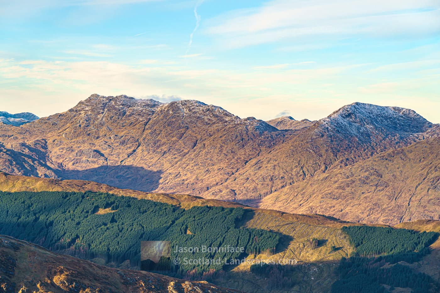
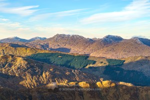
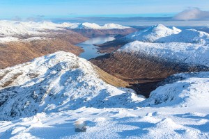
Sgurr na Ciche, Garbh Chioch Mhor and Sgurr nan Coireachan are lofty, rough and remote Munros at the west end of Glen Dessarry, just east of Knoydart, separated from the peninsula by the deep glen of the River Carnach that flows in to Loch Nevis at Camusrory. The mountains are most easily approached via Glen Dessarry from the end of the road at the west end of Loch Arkaig. The long single track road up Loch Arkaig is itself a bit of an experience but to then explore these wild and remote hills is something else again.
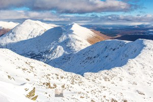
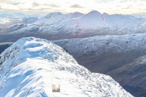
Sgurr na Ciche and Garbh Chioch Mhor are less than one kilometre apart, separated by the Feadan na Ciche bealach at 845 metres. Sgurr nan Coireachan is the most easterly of the three peaks some 2.5 kilometres from Garbh Chioch Mhor with the subsidiary top of Garbh Chioch Bheag and the Bealach Coire nan Gall at 733 metres between.


Sgurr na Ciche, Garbh Chioch Mhor and Sgurr nan Coireachan


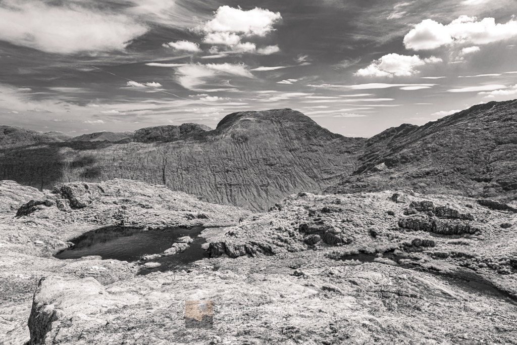
Table of Sgurr na Ciche, Garbh Chioch Mhor & Sgurr nan Coireachan details
| DoBIHID | Mountain | Height | Classification | Image 1 | Image 2 | Image 3 |
|---|---|---|---|---|---|---|
| 730 | Sgurr na Ciche | 1040m/3413ft | Munro | Context Image | Detail Image | Summit Image |
| 732 | Garbh Chioch Mhor | 1013m/3323ft | Munro | Context Image | Detail Image | Summit Image |
| 734 | Garbh Chioch Bheag | 968m/3177ft | Munro Top | Context Image | Detail Image | Summit Image |
| 736 | Sgurr nan Coireachan | 954m/3129ft | Munro | Context Image | Detail Image | Summit Image |
Depending on how much you like trudging the tracks a bike can be handy to get close to these hills, either by the track on the north side of Glen Dessarry or via the forestry track on the south side of the glen. This passes A’ Chuil bothy and can readily be cycled as far as the confluence of the Allt Coire nan Uth and the Allt a’ Ghiubhais, immediately below the south ridge of Sgurr nan Coireachan. The ridge is then easily gained via a path north through the woods, or another path leads north west towards the Bealach an Lagain Duibh.
A small path weaves through the outcrops up the south ridge of Sgurr nan Coireachan which is a fair plod to reach the south top before a slight descent and gentle ridge to the summit with great views on a good day. Bealach Coire nan Gall lies to the west at 733 metres and is gained fairly steeply via the west ridge. Beyond, the ridge meanders westwards over Garbh Chioch Bheag to Garbh Chioch Mhor – they live up to the garbh (rough) in their names. Beyond Garbh Chioch Mhor the ridge descends towards the north west and the Feadan na Ciche bealach. A sharp pull beyond leads on to the summit ridge of Sgurr na Ciche just east of the summit.
The quickest way down (or up) Sgurr na Ciche is probably via the gully of the upper Allt Coire na Ciche that heads down south west from the Feadan na Ciche bealach. Alternatively Sgurr na Ciche’s south west ridge can be used. It can be accessed just east of a small top on the ridge at 760m (OS 1:50k). The rough north east ridge can also be used to access the mountain from the west end of Loch Cuaich (Quoich) or to combine with an ascent of Beinn an Aodainn (Ben Aden).
Interactive map of Sgurr na Ciche, Garbh Chioch Mhor & Sgurr nan Coireachan
Important note: Routes on this map are provided as an indication only in good faith. They are approximate and indicative and should not be relied on for navigation or as a guarantee that any specific person will be capable of completing them. Hill information adapted from The Database of British and Irish Hills (DoBIH) under CC BY 4.0
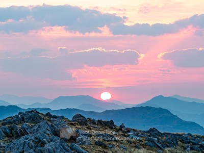
Sgurr na Ciche, Garbh Chioch Mhor & Sgurr nan Coireachan photo gallery – A selection of my best images illustrating these excellent mountains


See & read more about the Lochalsh & Knoydart area
Lochalsh & Knoydart select photo gallery

Lochalsh & Knoydart Interactive Map

Knoydart & South Loch Cuaich (Quoich) mountains

Kintail & North Glen Shiel mountains

Leave a Reply