
Interactive map of the Shetland Islands – photos, places and routes. Have a play and explore with the map, click on photos and routes to see and read more.
Discover and explore more of the wonderful sights of Shetland through the articles and links below.
| Search for accommodation using Booking.com |
| Buy maps from the Ordnance Survey |
| Buy guide books and maps from Amazon |
Photos and articles by area
Explore the wonderful landscapes of Scotland through the areas featured here - some of the most beautiful areas of Scotland; ...

Shetland Islands
The Shetland Islands are the northern most islands of Scotland and the British Isles and lie at 60 degrees north, ...

Shetland Islands select photo gallery
A select gallery of only my very best Shetland Islands photos. From amazing sunsets to diving gannets; ancient brochs to ...

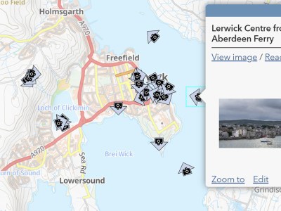
Shetland Islands interactive map
Interactive map of the Shetland Islands - photos, places and routes. Have a play and explore with the map, click ...

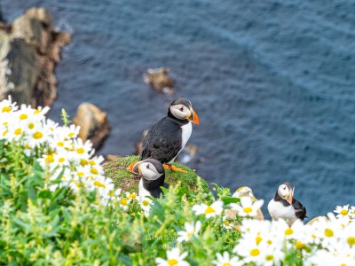
Scotland Landscapes – select photo gallery – my favourites
A select gallery of only my favourite or best shots from around Scotland. From puffins at Herma Ness on Unst ...

Exploring Ronas Hill, the Lang Ayre and Turls Head – North Roe, Shetland
Ronas Hill is Shetland's highest hill at just 450 metres in height. It would barely be noted as a hill ...
Shetland – Highlights of a Summer Visit
After postponing our planned 2020 trip to Shetland we were keen to make it in 2021 if safe to do ...
Purchase prints of my photos in a wide range of sizes and media at my online store at Redbubble.
Leave a Reply